Completing the Tongariro Alpine Crossing was a significant achievement for us and I thought deserving of it’s own blog post. We first heard about this hike from my young second cousins in the UK who were here last year and suggested we not miss the adventure, and so it became included in our New Zealand itinerary.
First, a few quick facts about this single day hike, among the most popular hikes in the country. The track is located in New Zealand’s oldest national park, the Tongariro National Park established in 1887, on the North Island. It has been designated as a World Heritage Site, acknowledged for it natural and cultural significance. The summits of Tongariro, Ngauruhoe and Ruapehu are sacred to the local Maori, as are the mountain lakes, which means you are not permitted to climb the summits or touch the lakes. The crossing passes over the volcanic terrain of the multi-cratered and active volcano Mount Tongariro, passing the Eastern base of Mount Ngauruhoe. The full distance of the track is 19.4 km (12.1 miles). Most of the walk is through raw volcanic terrain because the three volcanoes in the area are all highly active. Fumaroles (vents) emitting steam and sulphur dioxide gas are visible at several places during the walk. The lakes are deeply colored by the volcanic minerals which are dissolved in them resulting in varied and brilliant shades of blue. This is surely some of the best landscape views that New Zealand has to offer.
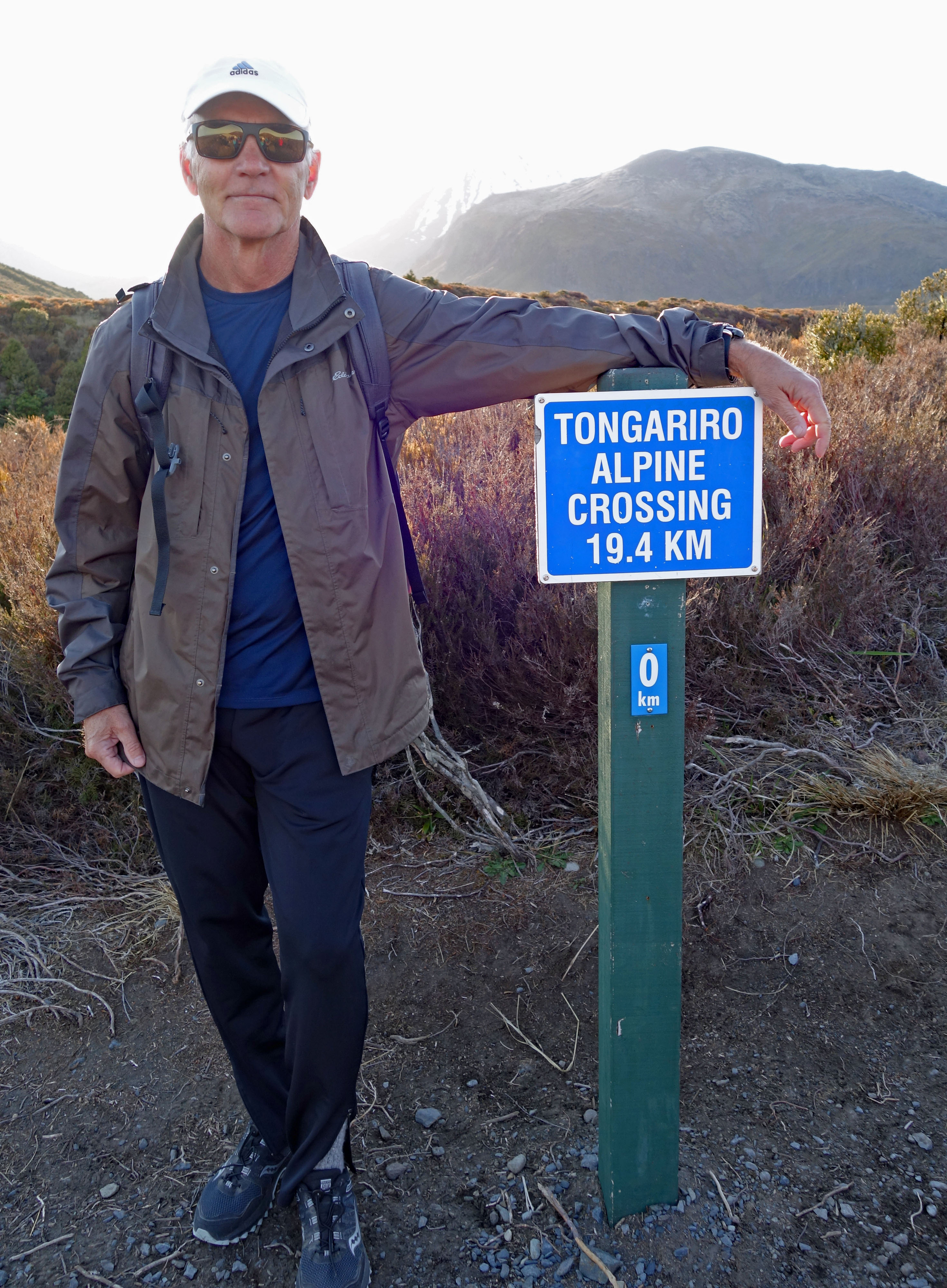
We planned our Tongariro Crossing 2 days in advance, after checking the weather forecast on the mountain and seeing a warm sunny day. We booked a one way shuttle bus leaving at 7:10 am from Ketetahi, the end of the hike, taking us to the Mangatepopo starting point, so upon finishing the hike we ended back at our car. The cost of a one way shuttle ride is NZD $30 (USD 19.25) each, this was the seniors rate although they never specify what age qualifies as a senior 🙂 There are many shuttle bus operators around Turangi, we chose Tongariro Expeditions just because there was a brochure in our Airbnb, plus their website was the easiest to navigate and make our reservation. They were very good, on time and efficiently run, we recommend them. The suggested direction for the one way hike is from Mangatepopo (elevation 1,120 m) to Ketetahi (elevation 760 m), because Mangetepopo is higher in altitude therefore requiring less climbing.
Hike day arrived clear and sunny, and with just a little trepidation of what the next 7+ hours would bring, we set off. Despite being very early in the season there were hundreds of people doing the crossing today. Of course being billed as one of New Zealands’s top one day walks inevitably means it will always be busy here.
Section 1 from the Mangatepopo car park to Soda Springs is described as an easy walk taking about 1 hour. This section follows the Mangatepopo Stream along a giant valley lined with lava flows and boulders, gradually ascending with the occasional steep bit thrown in.

Section 2 from Soda Springs to South Crater is described as a 1 hour hard ascent, they are not kidding. The trail map has this to say “Prepare yourself mentally for the challenge ahead. You can do it!! Put one foot in front of the other and breathe. Take in the views as you go and enjoy where you are. We call this the Devil’s Staircase. When you get to the top you are at the entry to the South Crater.”
Section 3 from South Crater to the base of Red Crater Ridge is described as a 15 minute easy walk, which is probably true when there is no snow! It was here we encountered our first snow field, crossing the giant South Crater covered in soft slushy snow was slow going. This is the point of no return, if the weather is bad you must turn around here and notify your shuttle bus company to pick you up back at the starting point. We enjoyed clear blue skies and moderate winds keeping the temperature comfortable so we set off across the crater. It took us more than 15 minutes slogging through the snow!!

Section 4 is the steepest and most difficult ascent in the hike up the Red Crater Ridge taking about 30 minutes. The trail map has this to say – “Caution is required as this section is steep and has a big drop on either side. This track can be scary when the winds are strong as you may get pushed around or even find you need to be on your hands and knees.” Today the winds were moderate and we had no problem on this section, other than slow progress due to the steepness of the grade!! Looking back along the ridge trail you get a fantastic view of Mount Ngauruhoe, “Mount Doom”, from the Lord of the Rings…WOW.

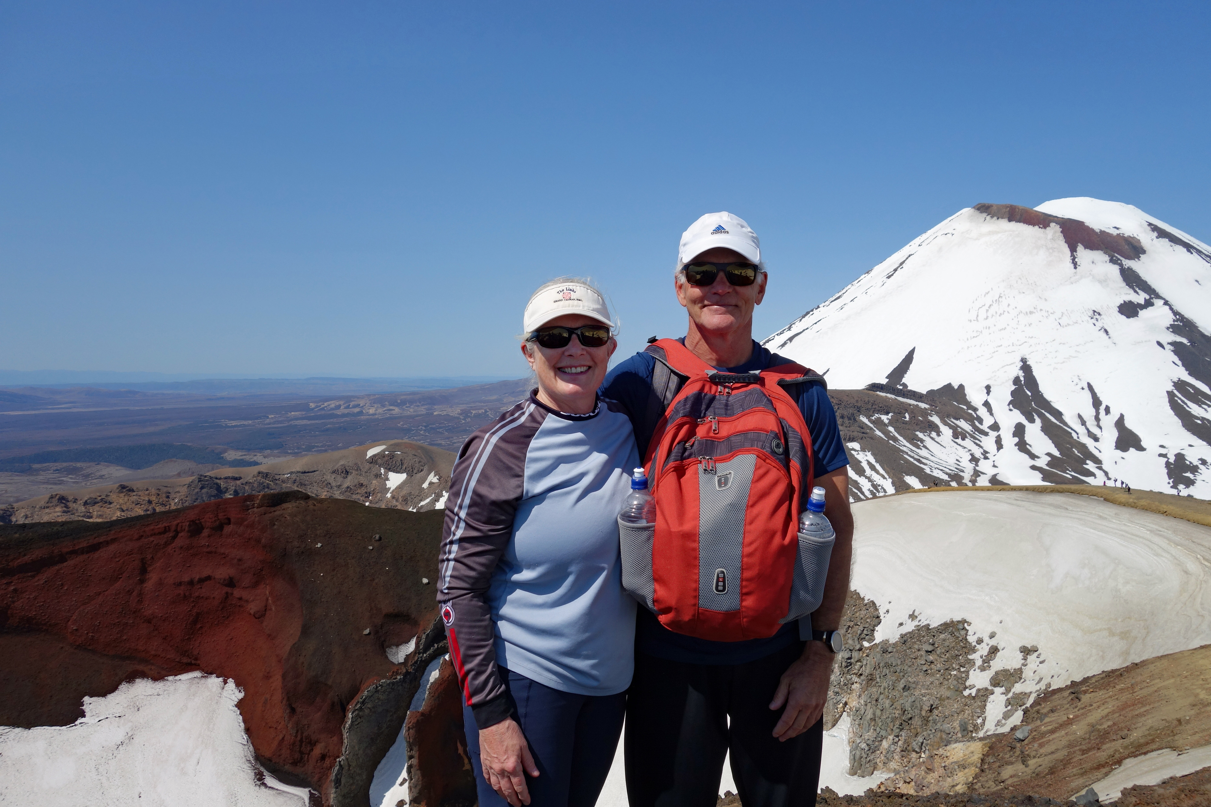
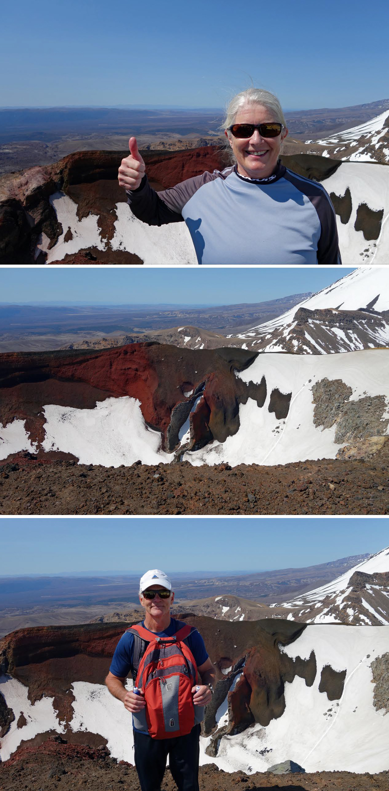
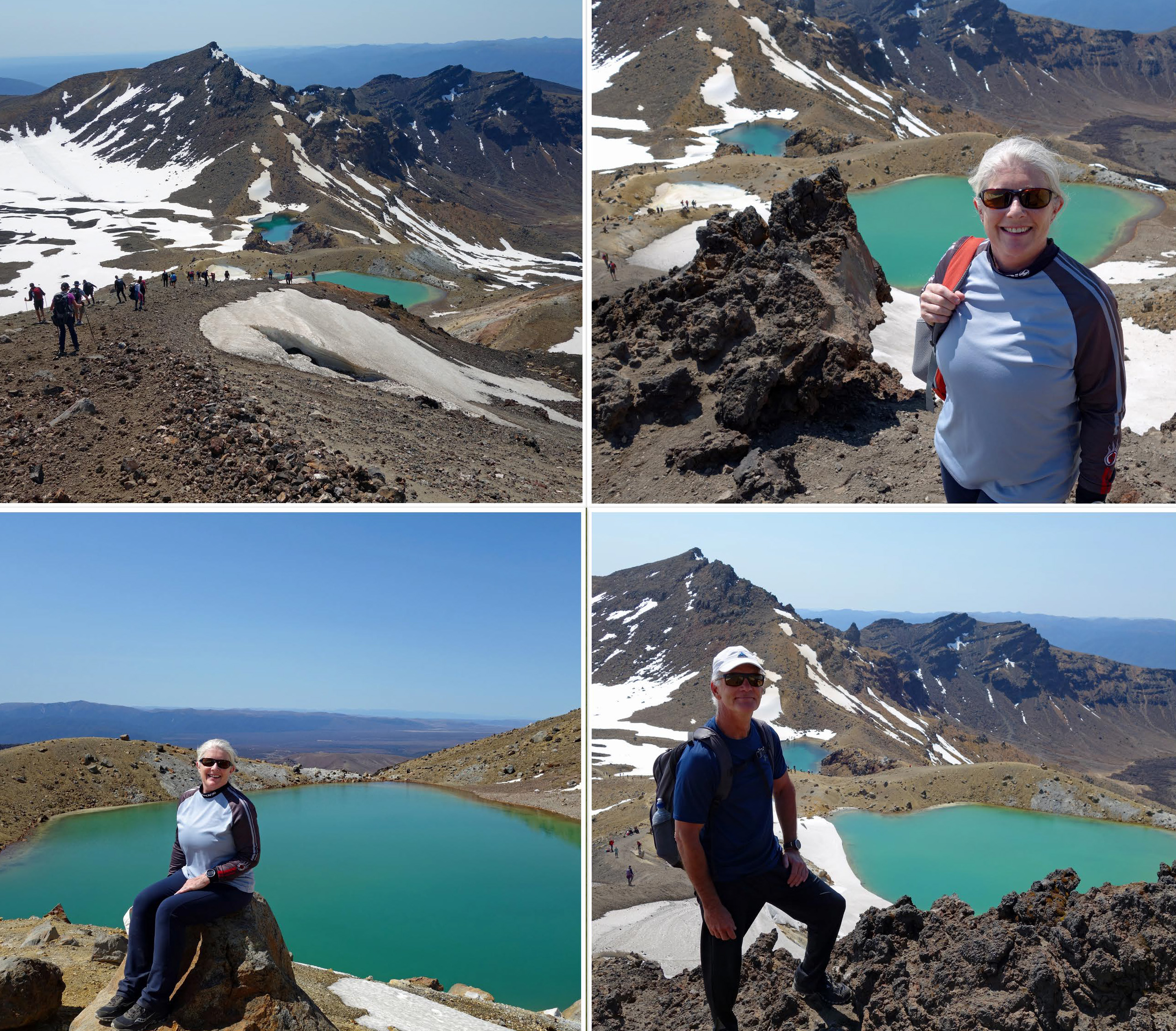
Pausing a few times to catch our breath, we eventually reached the top of the Red Crater, this is the half way point and the summit of the hike…WoooooHooooo we made it!!! The 360 degree views from here are incomparable!!! The dark ruby red earth is a gorgeous contrast against the bright blue sky and blinding white snow. This is one of those moments where we truly appreciate our nomadic lifestyle and being fit and healthy enough to see places like this.
Section 5 is described as an easy 15 minute descent from Red Crater to Emerald Lakes…SAY WHAT??? The first half of the way down to Emerald lakes is walking and sliding down loose scree and ash, we both slipped a couple of times and I overhead one young lady say it was the most stressful thing she has ever done!! It was not the easiest part of the entire trail, although the stops we made on the way down had some of the best views of the entire hike. The color of Emerald Lakes is mesmerising especially with snow lining the edges. We took a lunch break here and could have stayed longer, however to avoid stiffening up we pressed on.
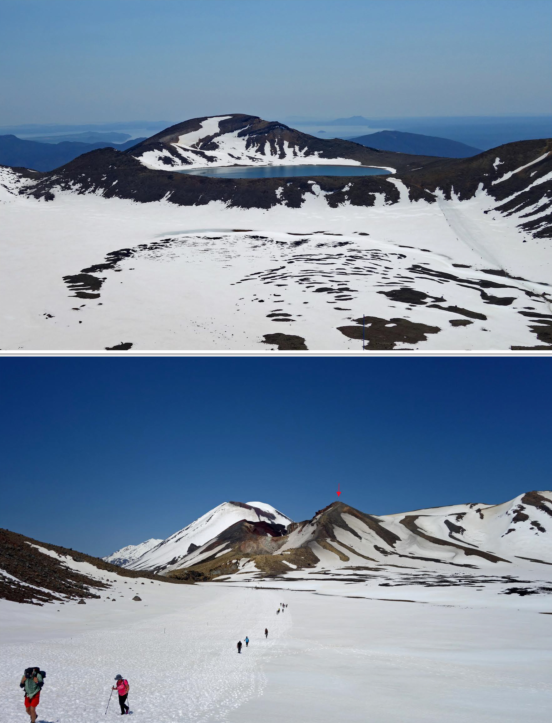
Section 6 is an easy 20 minute descent to Blue Lake from Emerald Lakes taking you through the Central Crater, which was filled with more soft slushy snow resulting in another slow trek across flat land. Once through the crater there is a mini climb to the rim of Blue Lake. The scenery here was phenomenal, it felt like we were on another planet 😲
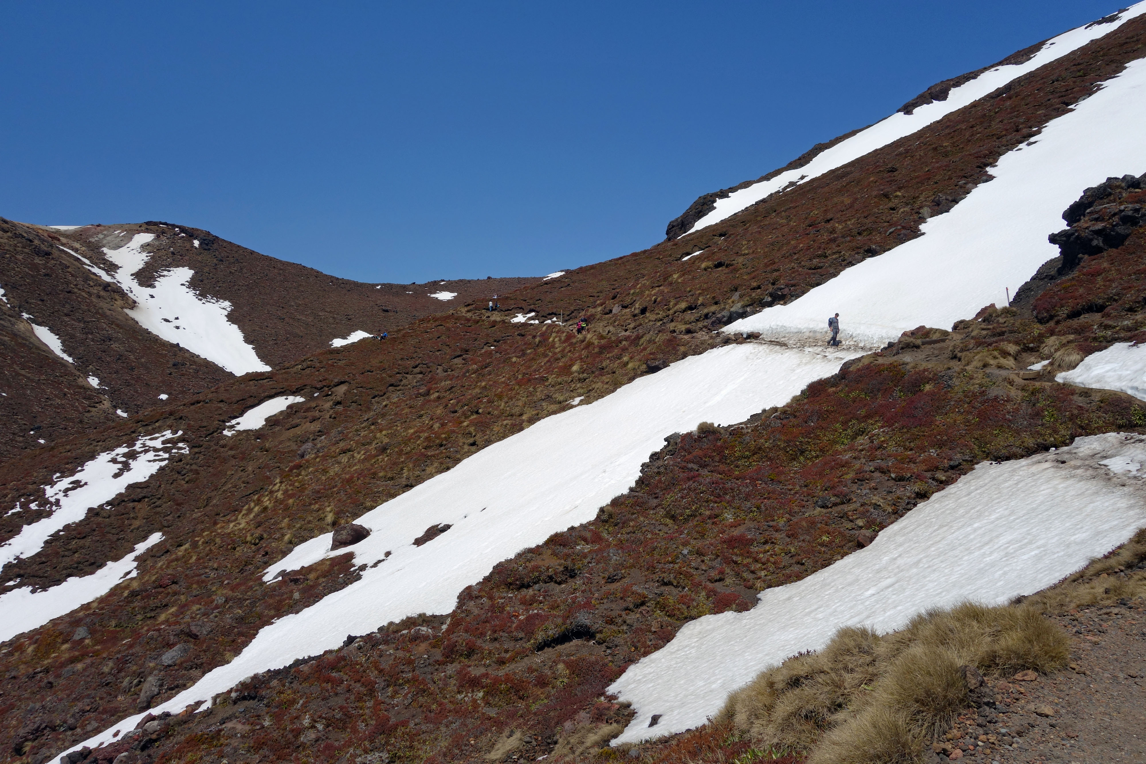
Section 7 is a 1 hour relatively easy descent along a winding track down the side of the volcano. We continued to encounter sections of snow along the trail.
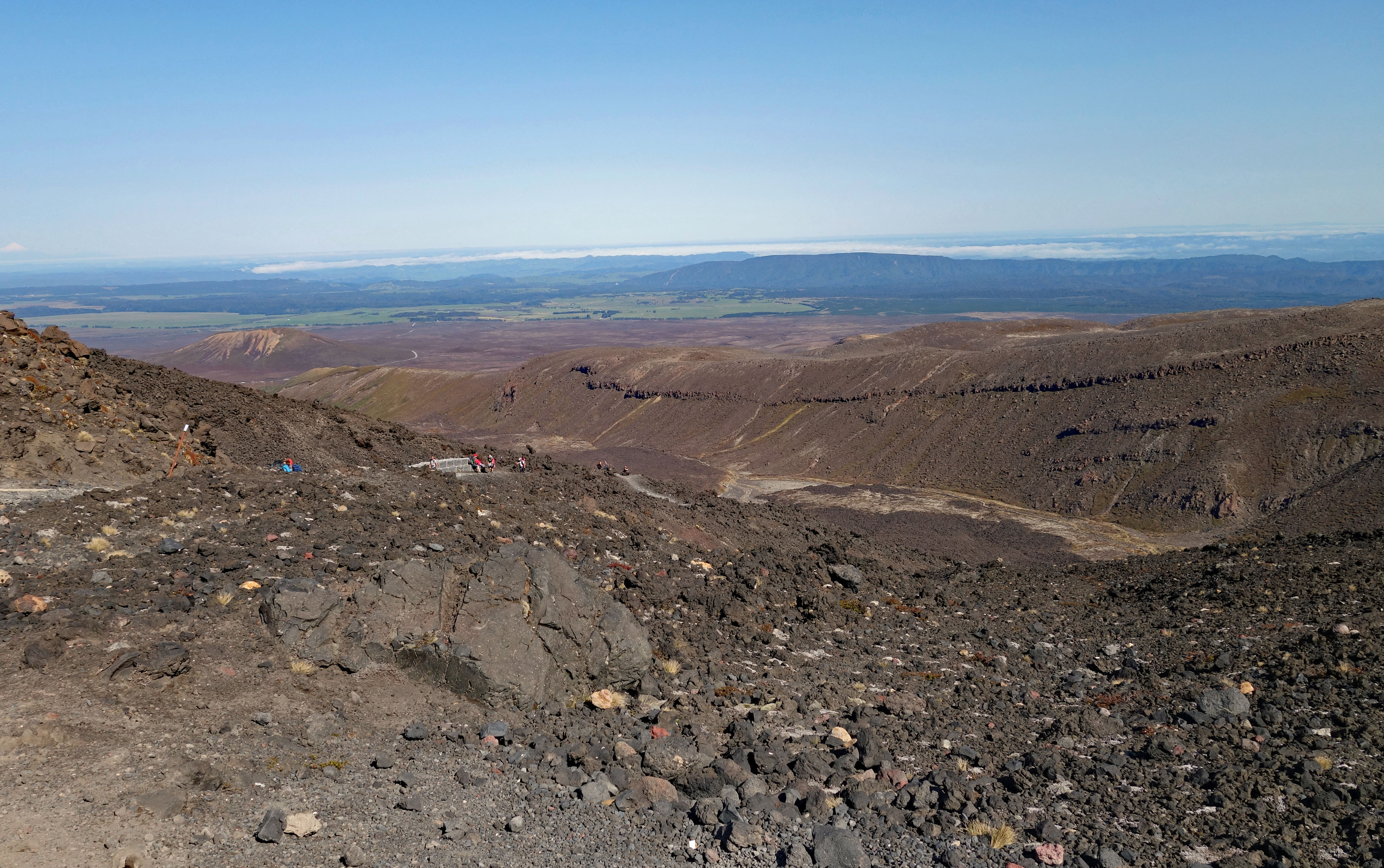
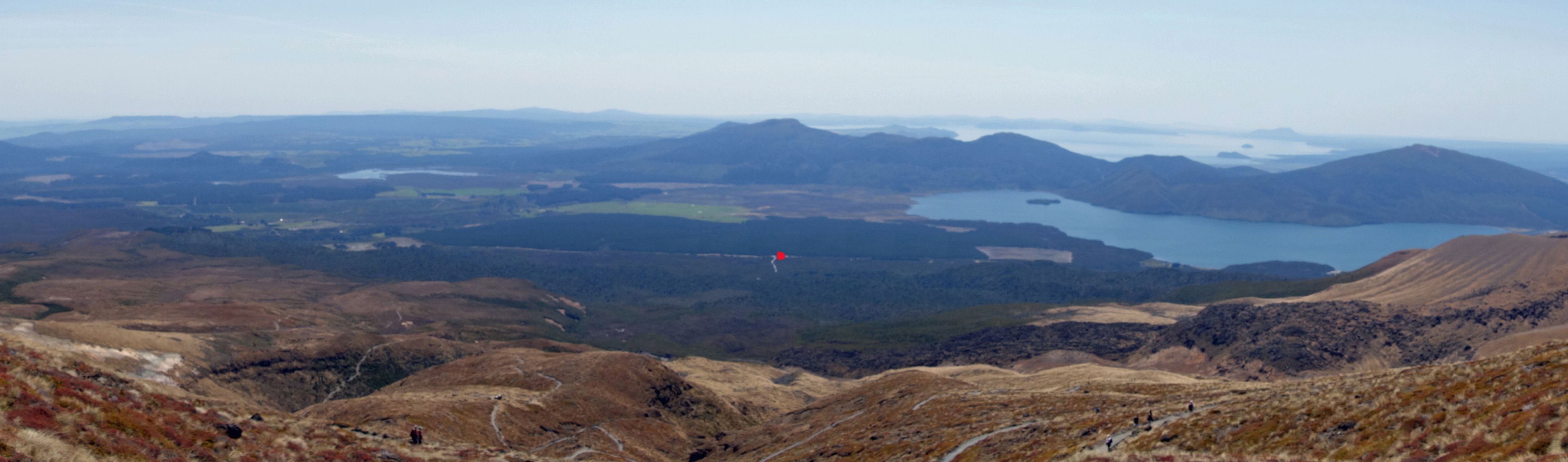
Section 8, the final one, is a long and rather boring descent taking 2 hours, known for feeling longer than it really is. The trail zigzags down the mountain teasing you with views of the finish line far off in the distance. We stopped for a second rest break to finish our lunch and enjoy the expansive views of Lake Taupo.
At the 3.2 km mark you think, OK not far to go now, but that is the beginning of what seem like thousands of downhill steps, at this point your legs are turning to jelly!! Adding insult to injury are a few uphill sections of stairs thrown in before you finally reach the end of the trail.

Emerging from the track there were big smiles, congratulations and pats on the back to both of us for a hike well done. 7 hours and 20 minutes including lunch stops…but then you realize your car is still a 1 km walk away along a gravel road. Shuttle buses picking hikers up for their return trip roared past enveloping us in cloud’s of dust as we made the trek to our car 😒 An imperfect end to what was overall a great hike, but we shrugged and walked on!
This blog would be incomplete without mentioning that my amazing husband carried my backpack for virtually all the steep climbing. Not sure I would not have made it without his help, so a million thanks Blair, you are a superstar, I love you to the moon and back 💖😘
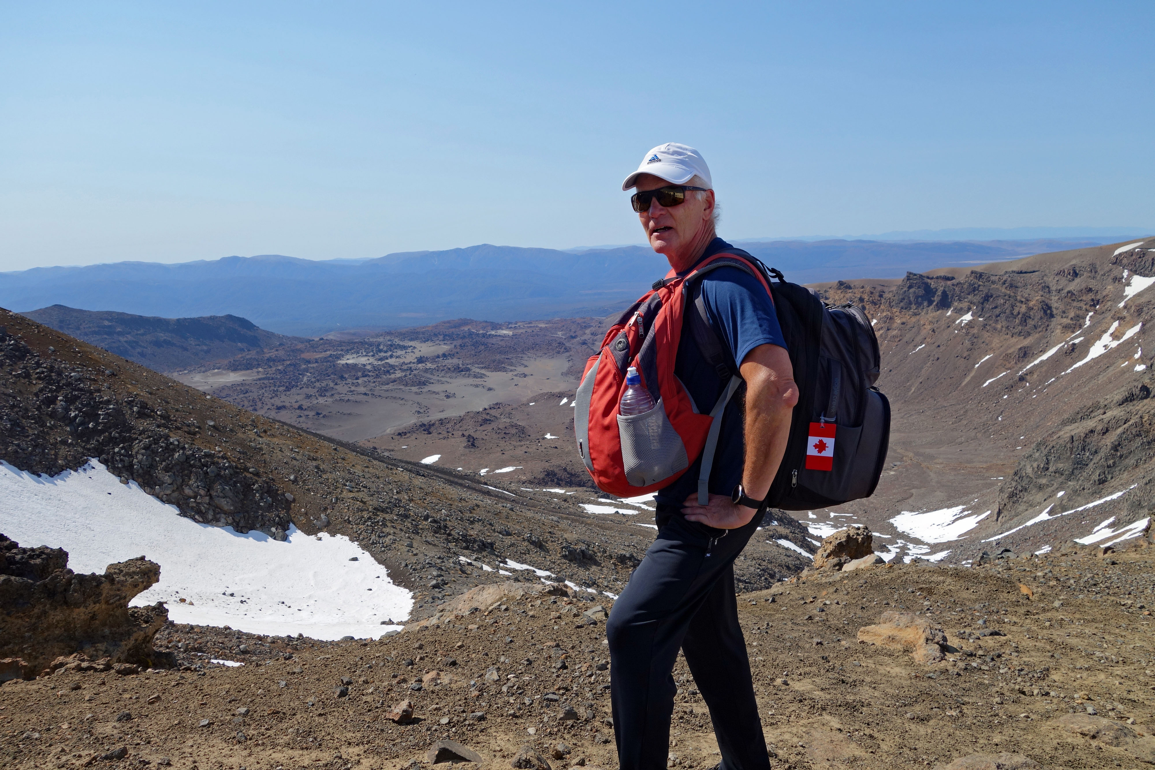
Thanks for all the hard work Blair 😘😘
In hindsight we did not need such heavy backpacks. I packed a sweatshirt, a jacket, hat, gloves and scarf that I never used. What you must take with you are tissues for using the toilets, sunscreen (keep applying it), lunch and snacks, water (there is none available on the hike). With the crossing easily accessible to large numbers of tourists and walkers each year, the Department of Conservation is concerned about hikers being unprepared so they are very good at detailing what you need to take and be prepared for sudden weather changes. Lucky for me I have a strong husband to help when the going gets tough 💪 Looking around during our walk we noticed that of the hundreds of hikers we saw, less than a dozen others appeared to be close to our age. Hint, do it while you are young…LOL
The final verdict…..
Was it worth it???…..ABSOLUTELY!!!!!!!!
Would we do it again???…..ABSOLUTELY!!!!!!!!
We have one more epic hike planned for the South Island in early December so keep an eye out for that post…..
Trip Tips
Check the weather forecast here to ensure you have the best weather possible for your amazing hike.
There are numerous shuttle operators and we were very happy with Tongariro Expeditions. Their prices are comparable to other companies and we found their service very efficient.
very cool! Reading, reminds me of Kilmanjaro. I never knew scree was the right word, but I get you. Beautiful.
Hi Gary, I’m sure you have loads of memories from Kilimanjaro, that was a much more epic hike than our one day adventure for sure. Not sure I would be up for what you guys’ did.