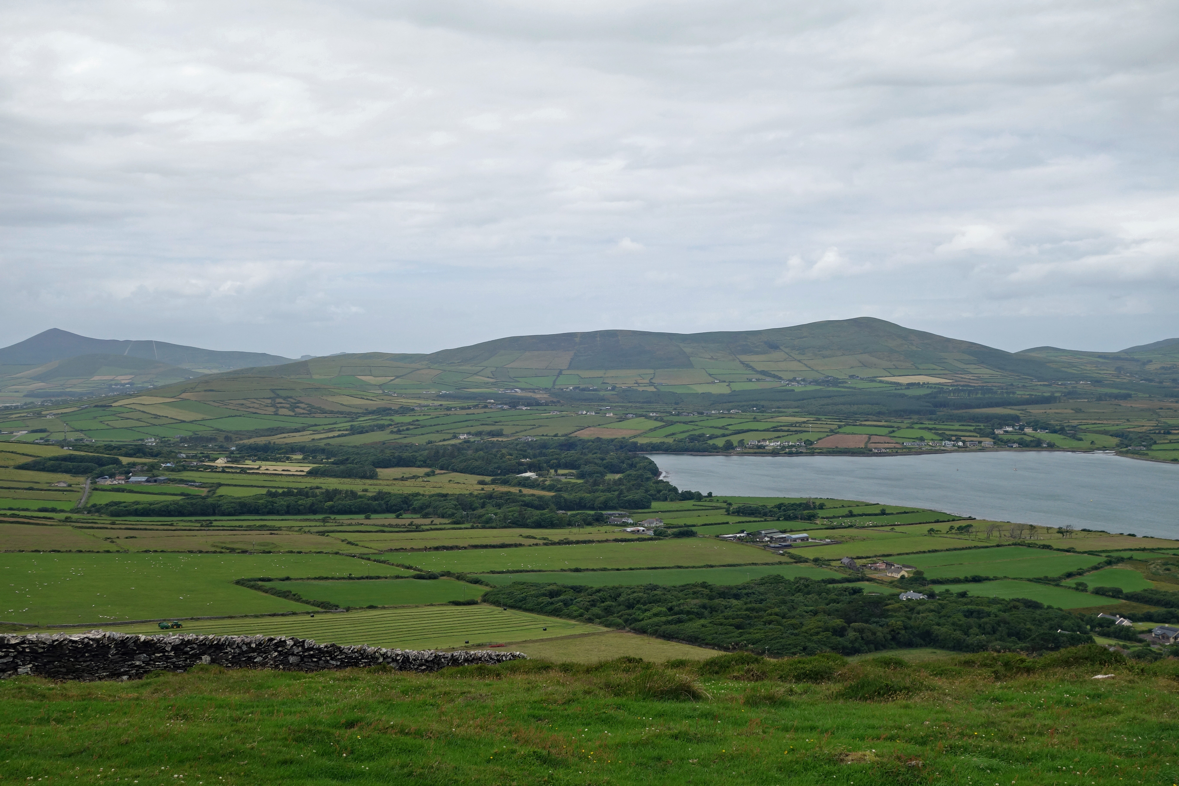
We arrived here from Bandon to a complete turnaround in weather, the wind and rain was howling off the Atlantic and the clouds obscured the hilltops. The Dingle Peninsula is much more exposed to the cold Atlantic winds than our last place which was close to the eastern side of the island. Something interesting we learned from someone at the gym in Bandon is that quite a few areas nearby were filming locations for a couple of the Star Wars movies…who knew!!
This particular area of Ireland is also where the most “Irish” is spoken with a number of signs only in Irish. There is an Irish language girls boarding school in Dingle and Irish language summer camps are available here. It’s nice to see an old language being taught and not lost over time.

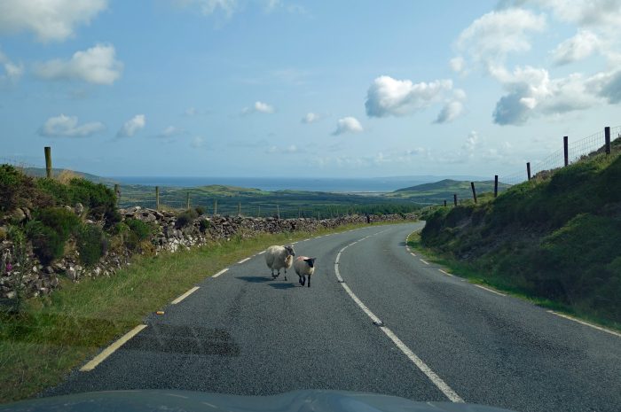
There are over two thousand ancient sites around the Dingle peninsula so it’s easy to find something interesting along any road that you drive. However, the main attraction to this area is driving the Wild Atlantic Way which we did a number of times. Here are a few of the places we found during our travels:
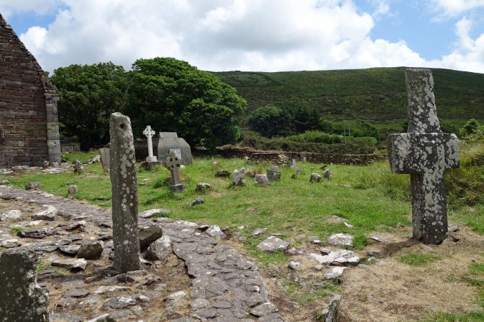
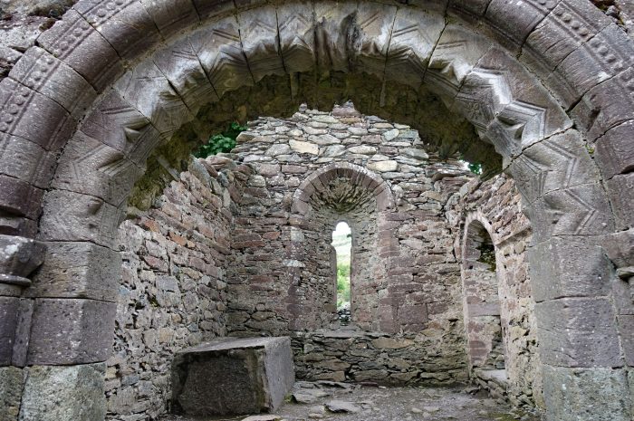
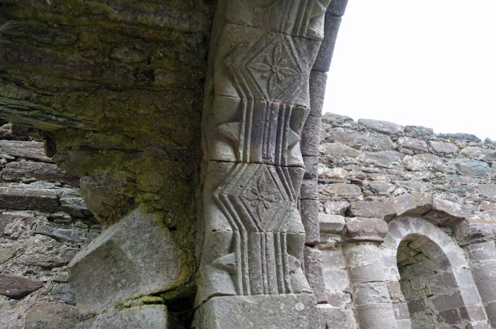
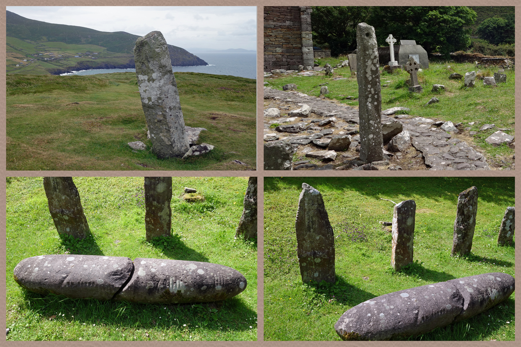
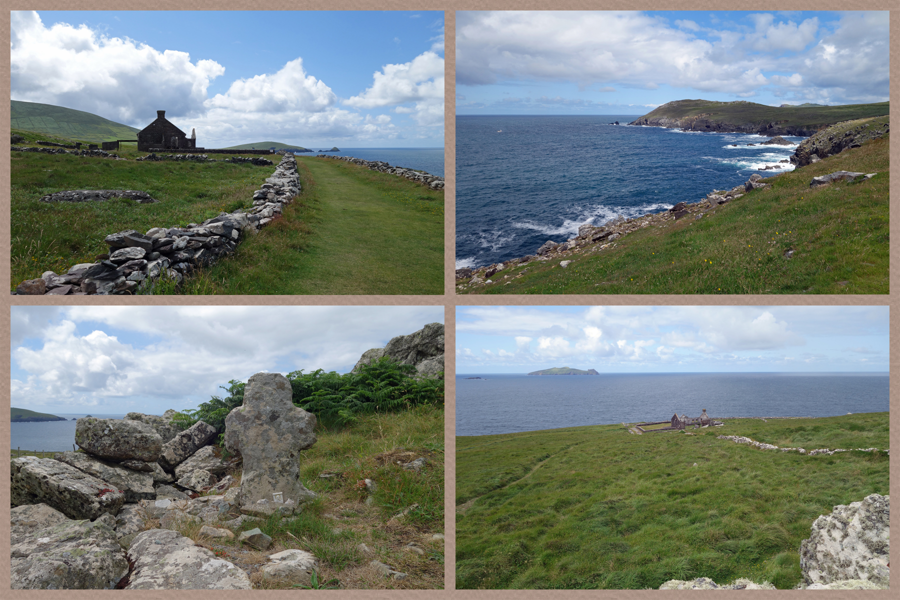
KILMALKEADER (Cill Mhaoilcheadair) is one of the most important early church sites on the Dingle Peninsula. The present church built in the middle of the 12th century is a fine example of Irish Romanesque architecture with a highly decorated interior and exterior. It was the Norman center of worship for this end of the peninsula. A 6th century stone inscribed with the Latin alphabet stands near an interior arch. Outside in the graveyard is an early sundial, a large stone cross and an ogham stone.
 Kilmalkeader Church


OGHAM STONES Ogham is the earliest form of writing in Ireland, dating from around the 4th century. The Ogham alphabet is a series of strokes and was usually carved on a stone to commemorate someone. We would see a few of these during our travels around the Dingle Peninsula.
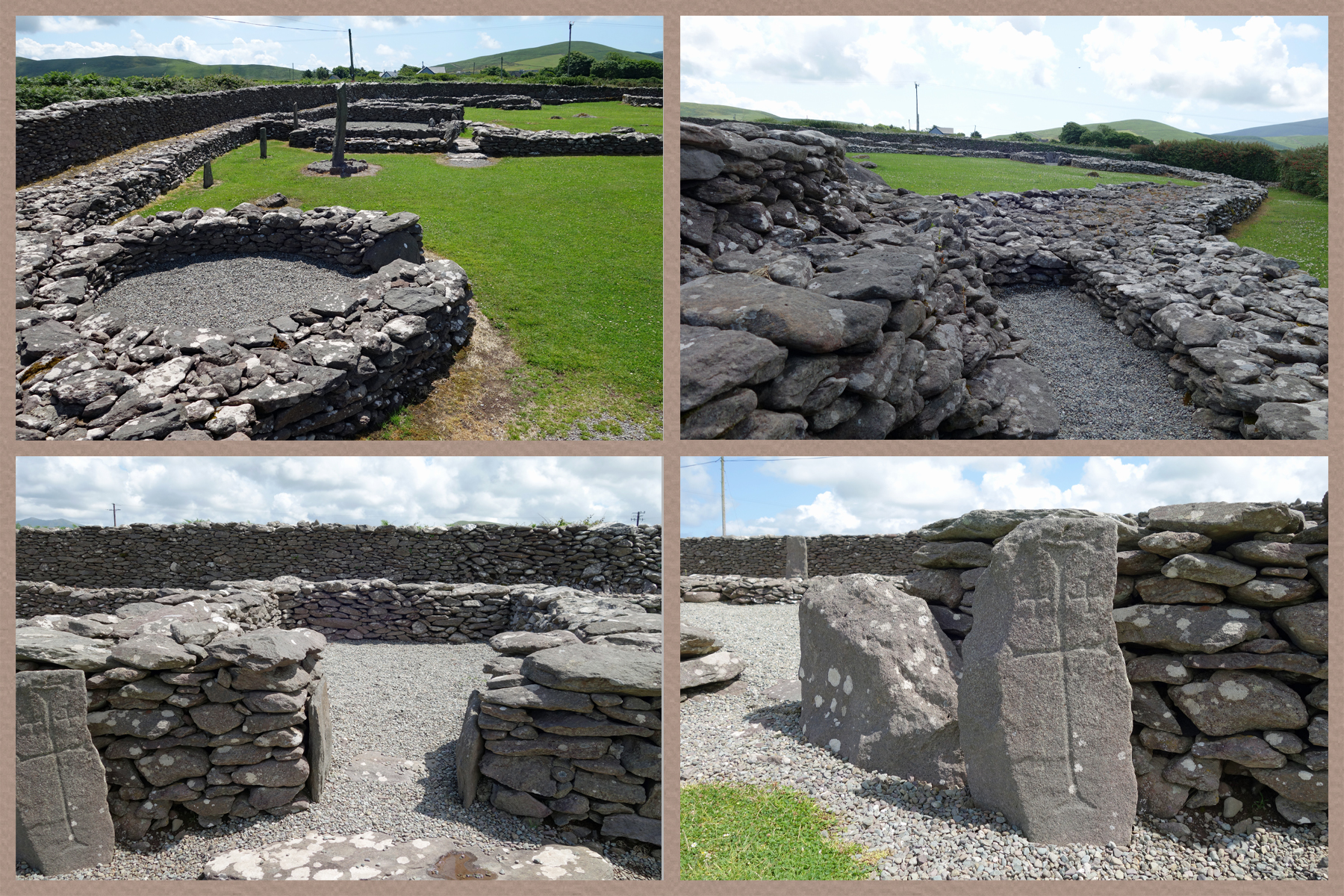
RIASC (An Riasc) is an early monastic settlement dating from the 6th century. What remains is the stony footprint outlining the layout of buildings. An inner wall divided the community into sections for prayer and business endeavors which helped support the monastery.
GALLARUS ORATORY (Séipéilín Ghallarais) is one of Ireland’s best preserved early Christian churches, dating from the 8th century It’s probably Ireland’s finest example of dry-stone building and it’s the only one of it’s type still intact in Western Europe. It’s a pretty cool building!!

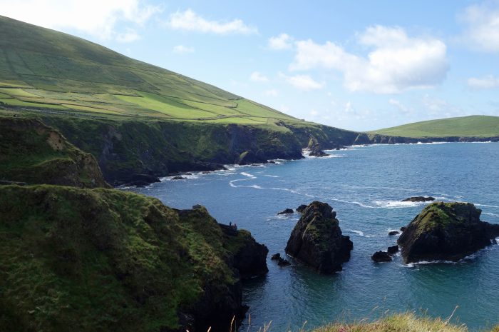
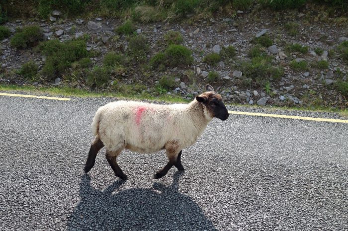
DUNMORE HEAD (An Dun Mor) is the westernmost point, and one of the most beautiful places, of mainland Ireland. Just off the road is a small parking lot where you can walk down to Coumeenoole Beach or up to the top of the head…we went up! The walk is on private property so there is an honesty box at the trailhead asking for 1 Euro per person to access the land. This is sheep grazing land so there is lots, and I mean lots, of sheep poop to avoid while hiking. The trail is a 2 km loop with the uphill section running along the edge of the cliffs and the downhill section passing through the fields. Because it’s rather steep getting up to the top, there are not that many folks on this hike, perfect!! The views are spectacular all the way up as you look out over the Blasket Islands and the wild Atlantic Ocean. At the top of the hill there is an ancient Ogham stone.
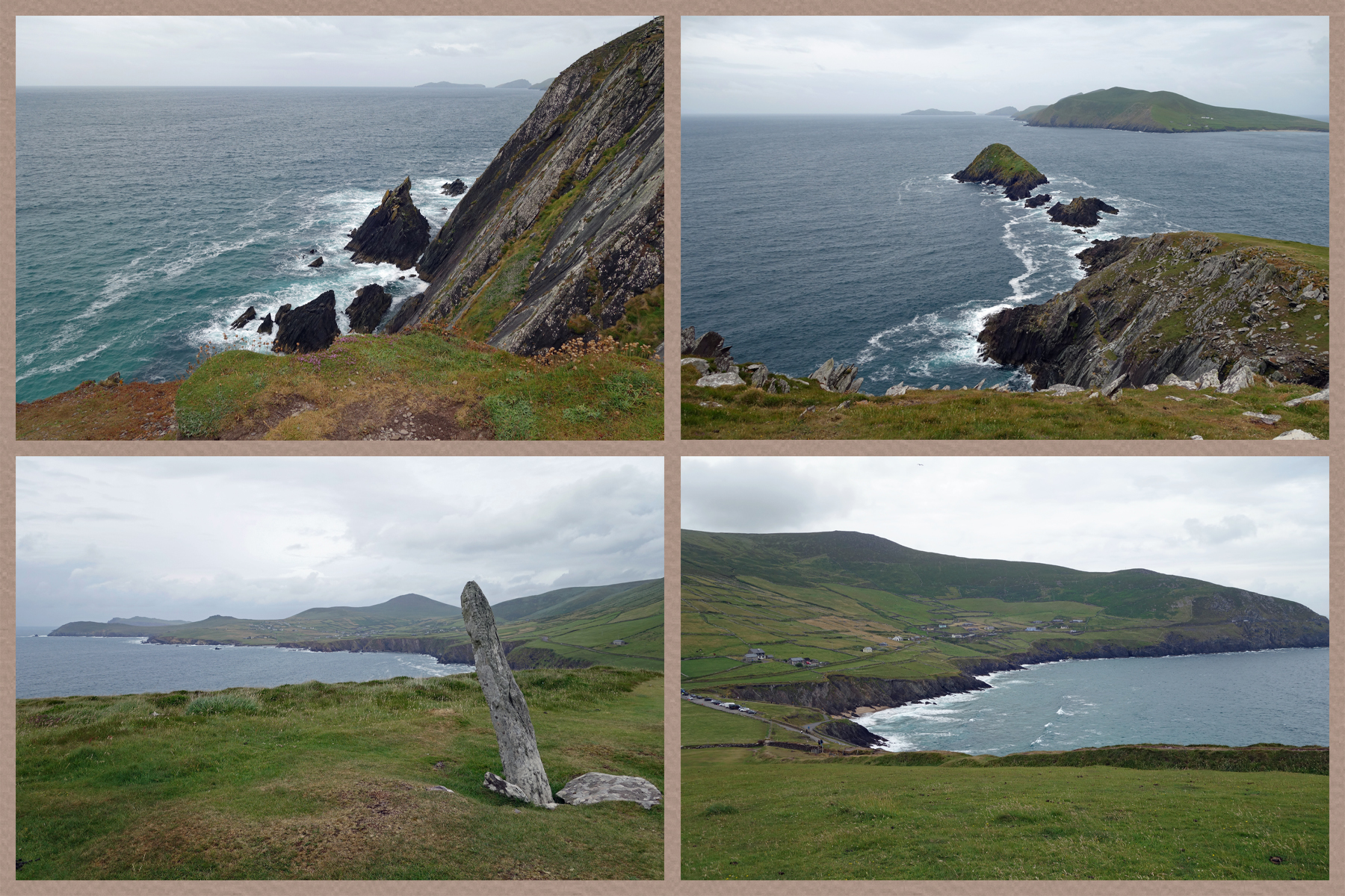
CLOGHER HEAD (Ceann Chlochair) From the roadside pullout it’s a 15 minute walk to the headland where we were rewarded with panoramic views of Clogher Beach, Sybil Point (Star Wars The Last Jedi filming location), the Three Sisters, Mount Brandon (in the clouds), Blasket Sound and Blasket Islands. It was a cloudy day during our visit, I imagine it must be unbelievably beautiful on a sunny day.

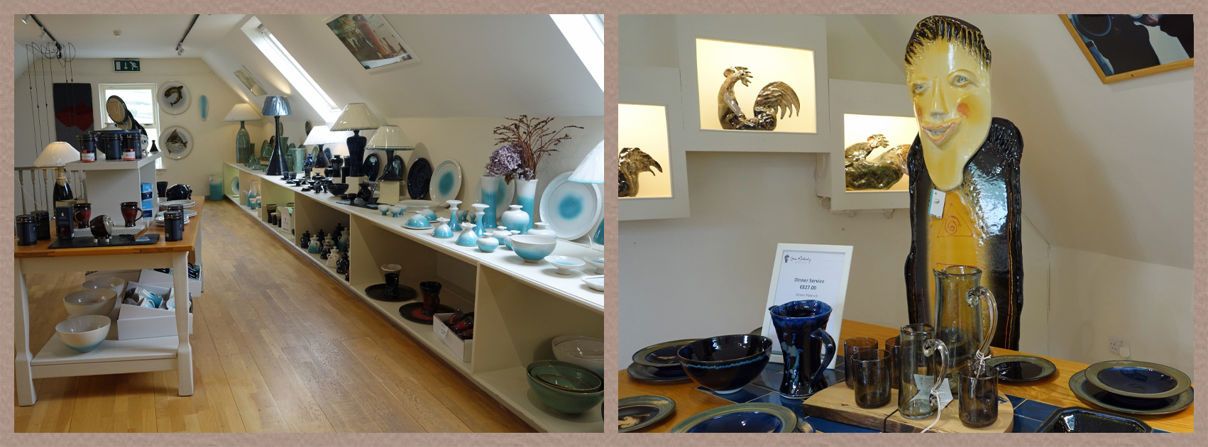
LOUIS MULCAHY is famous worldwide for his distinctive pottery. His workshop has an amazing display of items for sale, and they are not cheap, but for one of a kind pieces it’s worth it. We did not buy anything for our suitcase 😂
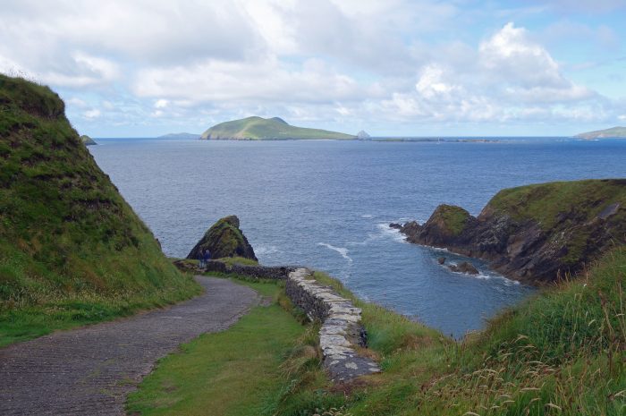
DUNQUIN PIER (Ce Dhun Chaoin) Parking alongside the road above the pier there is a paved route down to the boat dock, and yes some intellectually challenged folks actually try to drive down here 🤣🤣 This unique pier serves as a departure point for the Blasket Island ferry, but the sea here is very rough most of the time so I don’t think the ferry runs that often. Making our way down the steep walkway, the views are mesmerizing. At the top of the cliffs is a lovely little trailer serving coffee and the most delicious brownies, where we enjoyed sitting in a rare moment of sunshine overlooking the islands.


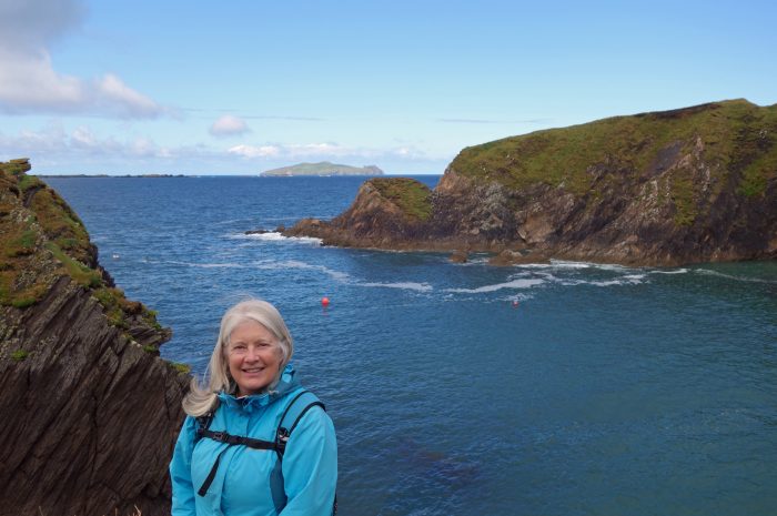
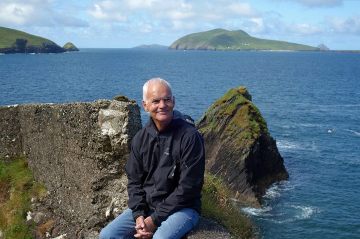

BLASKET CENTER (Ionad an Bhlascaoid) viewing platform is just past the heritage museum building and has been built at the edge of the cliffs to admire the views out to Great Blasket Island. Great Blasket Island was inhabited until 1953 when the Irish Government decided the living conditions were too harsh and the island too remote for people to live on and everyone was forcibly evacuated. From the viewing platform we headed off on a bit of a hike along the clifftops. We came upon an old schoolhouse which I found out later was built for the 1970 movie Ryans Daughter (there are a few filming locations around this area) Of course, we also found a few little ruins along the way which had no explanations.
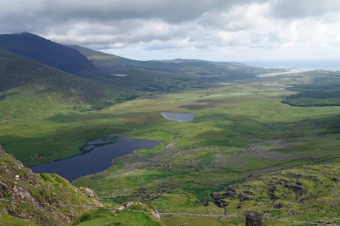
CONNOR PAS (An Chonair) is the highest paved pass in Ireland at 1,496 ft which for folks who grew up in Calgary, Alberta (elevation 4,000 ft) seems not very high at all. But hey, you work with what you’ve got 😁 Connor pass may not be high, but the road is interesting with a small section clinging to the cliff just wide enough for one car. Fortunately, there are quite a few wider spots where two cars can squeeze by so it’s not that bad a drive after all. In fact, we did it twice coming back the same way over to our side of the peninsula. From the top of the pass there are breathtaking views of a landscape created by glaciers millions of years ago.
- View from Connor Pass


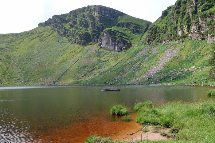
CONNOR PASS WATERFALL is just past the summit as you continue heading north and down the road. The waterfall is fed from Peddlers Lake (Lough Doon) just above the road. To reach the lake is a scramble up the rock face, so I left this task to Blair and sent him on his way with the camera 😂

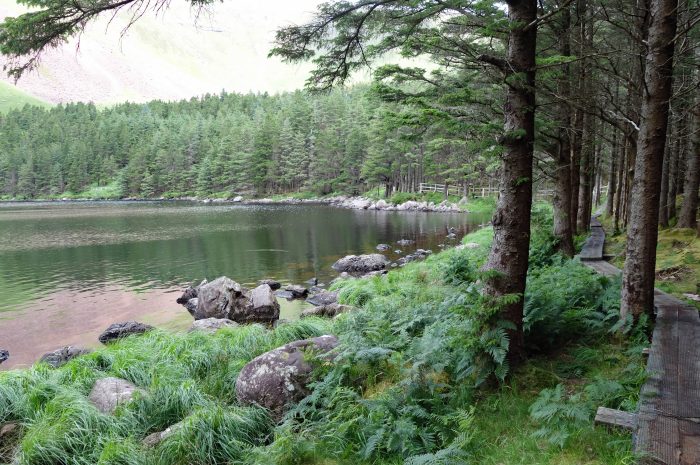
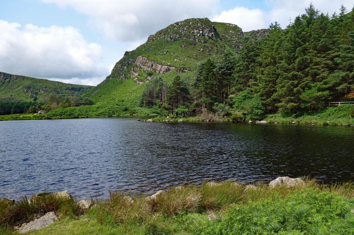
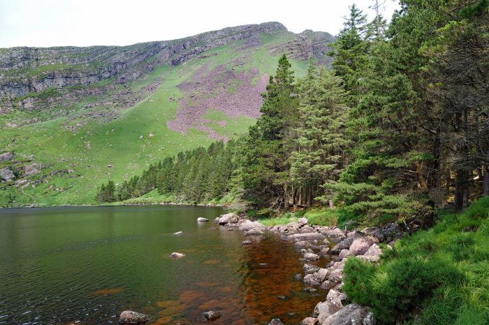
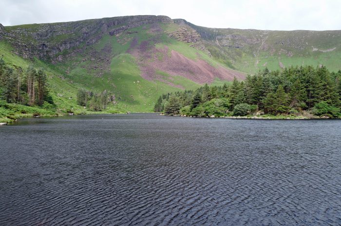
GLANTEENASSIG WOOD (Choill Ghleann Ti An Easaigh) is a 450 hectare area of woodland, mountains, lakes and peatland, recommended by our host as somewhere to go after we had gone over Connor Pass and were on the other side. It’s a bit of a drive to get here, partially on a gravel logging road, but beautiful when we got there. At the end of the road is Lough Slat and Lough Caum, two pretty lakes surrounded by hills (not really mountains to us Canadians). Lough Slat has a few picnic tables and that’s about it but Lough Caum has a 1.8 km boardwalk around the perimeter and was a really pretty walk. Not too many people come here so we enjoyed a quiet walk and lunch by the lakeside.
- Lough Slat
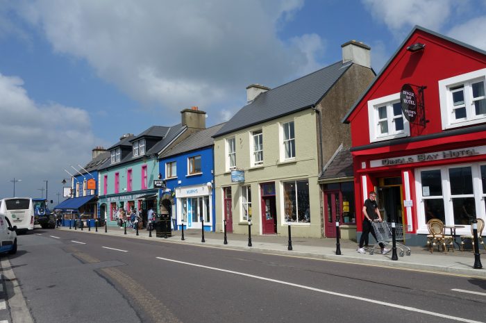
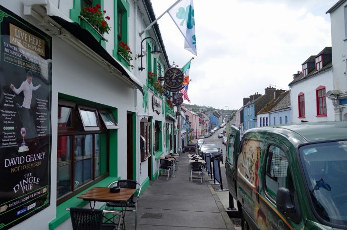
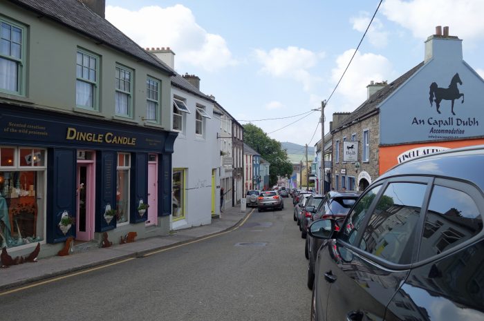
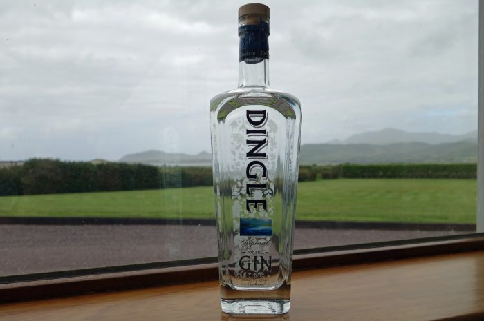
DINGLE (Daingean Uí Chúis) town itself is a brief stop for the many tourist buses so there are endless shops, pubs and cafes catering to the daily influx of visitors. We did not spend a lot of time walking around town, it was just too busy for us, but we did pop in regularly to go to the supermarket. It’s a great place if you are looking to buy souvenirs but I think most people carry on around the Wild Atlantic Way to see the magnificent scenery of the Dingle Peninsula, I know that’s where we spent most of our time. Supporting the local economy, we purchased a bottle of Dingle Gin, distilled just outside town and ranked as one of the top 3 gins produced in Ireland. We’ve got a couple of months to get through the bottle, which shouldn’t be a problem 😁 Special mention must be made of Murphy’s Ice Cream, made from local Kerry cattle milk, it was very yummy🍦and the lineups usually pretty long to get a cone! We tried to do our sightseeing around town early in the morning, so the crowds were pretty minimal.
- Murphy's Ice Cream shop in Dingle


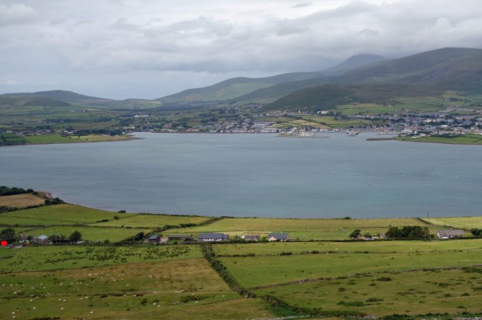
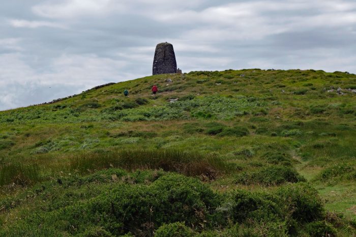
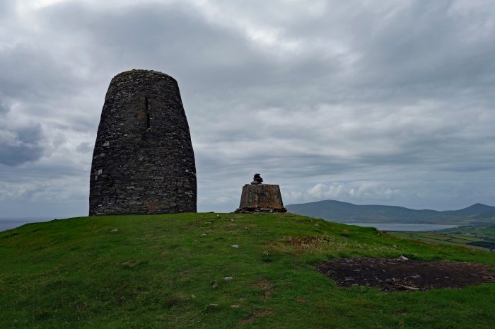
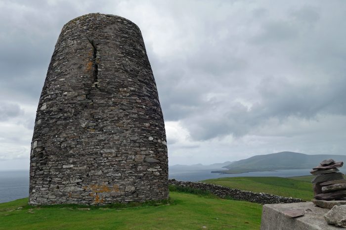
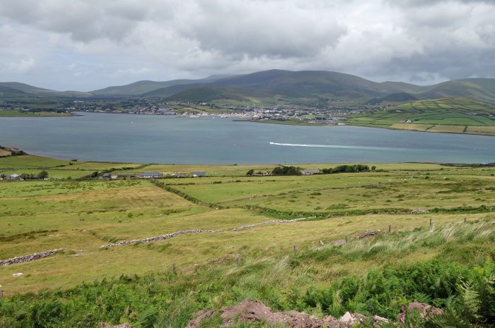
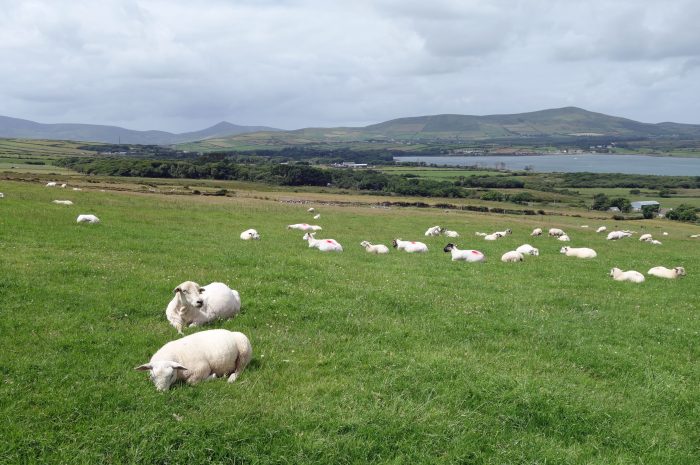
EASK TOWER is a solid stone tower atop Carhoo Hill, overlooking Dingle harbor. The tower was built in 1847 in order to guide ships into the mouth of the harbor and to provide work to local residents during the Great Famine. Beside the tower is a WWII look-out post which thankfully we could get inside because the rains came while we were at the top!! Once the rain cloud passed we enjoyed panoramic views over the Dingle Peninsula, Dingle Harbor, Skellig Rocks and the Iveragh Peninsula. Because the tower is on private land it costs 2 Euros each to walk through their sheep fields. Lots of sheep…and you know what sheep do…yep, lots of poop too!!! It’s about 1.5 km to the top and takes roughly 30 minutes to get there.
- Our car is where the red dots are, bottom left

We spent 9 nights/8 days here on the Dingle Peninsula and perhaps because of the weather, we felt it was maybe 3 days too long. There is not much to do if the weather is bad, and we had 3 days of heavy rains that kept us housebound. If there was a gym around, that would have helped kill some time but there are none. On the other hand, it was nice to have some down time and not be rushed seeing the sights, it is spectacularly beautiful here when the sun shines 🌞
So, we are off to Kenmare next and hopefully there will be more to do in that area of County Kerry…..
An té a bhíónn siúlach, bíonn scéalach
He who travels has stories to tell
Southwest Ireland is truly beautiful from my teenage memories of a visit near Bantry Bay. Keep enjoying ‘the green isle’.
Thanks Sandra! We are enjoying ourselves for sure…in between all the rain showers ☔😁