The morning after we arrived in Kenmare we stopped in at the tourist office for a chat and the lady on staff suggested it was going to be a good day to drive the Ring of Kerry from Kenmare to Portmagee. This disagreed with our weather app, but she’s Irish and maybe she knows better…..nope!! It was relatively dry but we certainly did not have any sunshine and we got drenched hiking the Kerry Cliffs, where I quickly learned that my 5 year old raincoat is no longer waterproof 😭 so I will be shopping for a replacement in Kenmare. (PS I found a beautiful raincoat in Kenmare, made by an Irish company in Belfast, so they aught to know waterproof 😂)
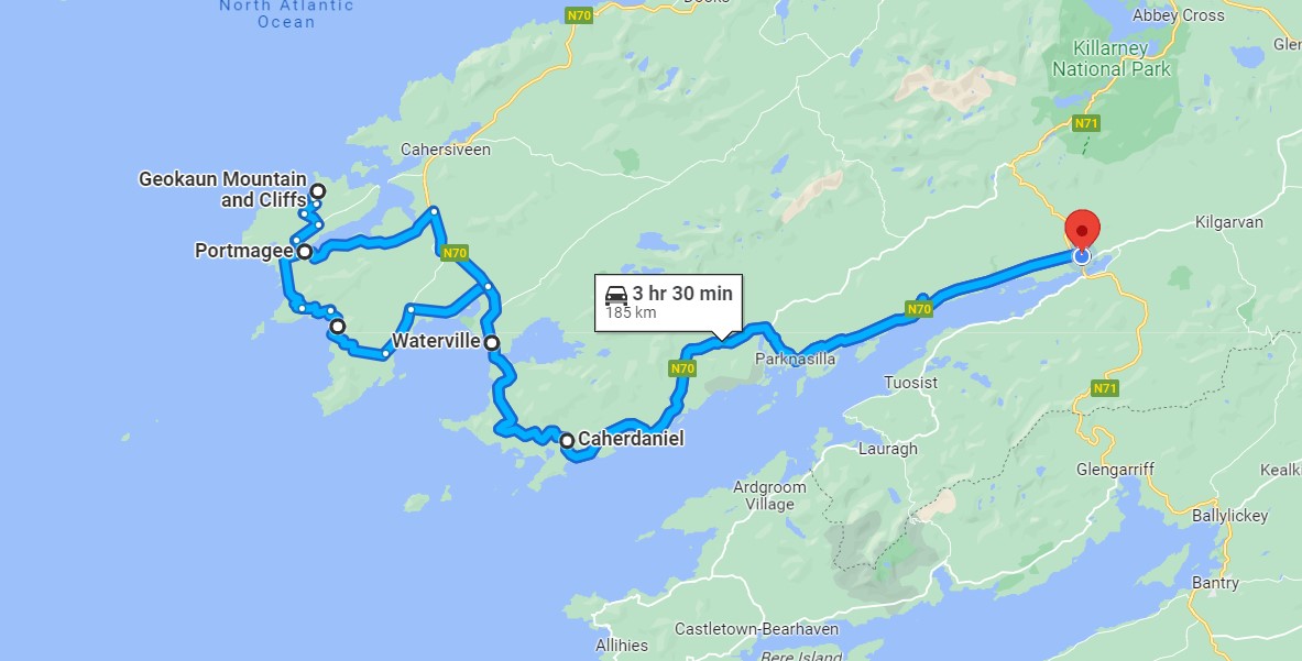
Overall the Ring of Kerry drive was a pretty one but in our opinion not as pretty as the drive around the Dingle Peninsula. The Ring of Kerry is a much longer route with not as many sights to stop and look at so we felt like we did a lot of driving for little reward. From Kenmare to Portmagee, with a brief detour to Valentia Island, was 188 km round trip and takes 3.5 hours without stops according to Google Maps. Including our photo/hiking stops and lunch in Portmagee our day was around 6 hours long.
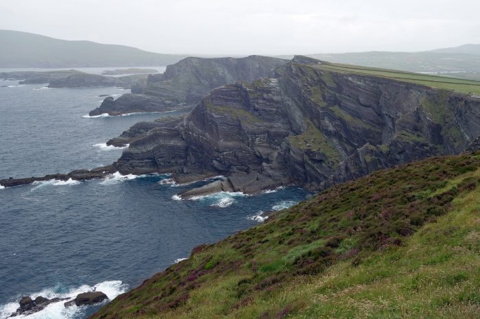
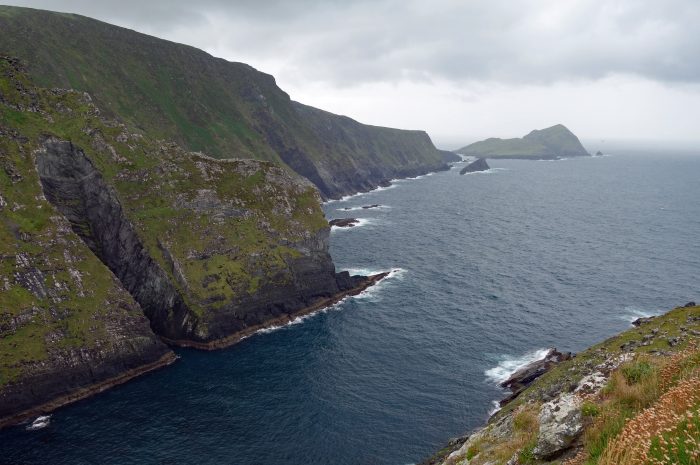
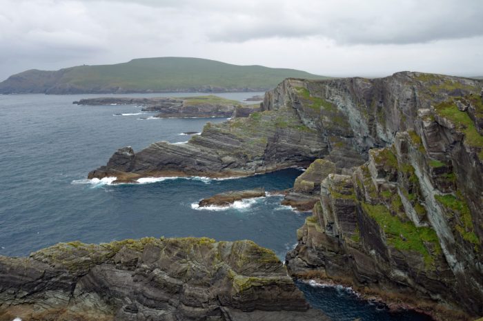
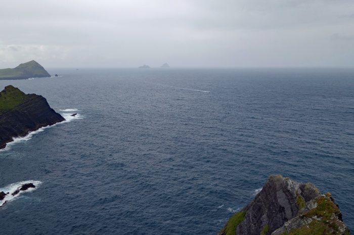
KERRY CLIFFS (Aillte Chiarrai) was the most spectacular stop of our drive along the Ring of Kerry, they are widely accepted as the most spectacular cliffs in County Kerry. The cliffs rise over 1,000 ft above the Atlantic and were formed more than 400 million years ago. To access the cliffs you must cross private land, a ticket to hike to the edge costs 5 Euros ($5.45 USD) each. Sadly for us it was raining and the wind was howling, so not the best experience. To the west are the amazing Skellig Rocks jutting straight up out of the ocean and one of only three UNESCO world heritage sites in Ireland. The Kerry Cliffs are the closest viewing point to the great rocks. Skellig Michael was used as a Star Wars filming location so there are lots of Star Wars tourist trinkets to be found in the nearby towns. We heard that if you want to land on Skellig Michael you must book tickets months in advance and many trips are cancelled due to rough seas, plus there is a limit of how many people per year are allowed on the island. Sounds like a miracle if anyone makes it there!
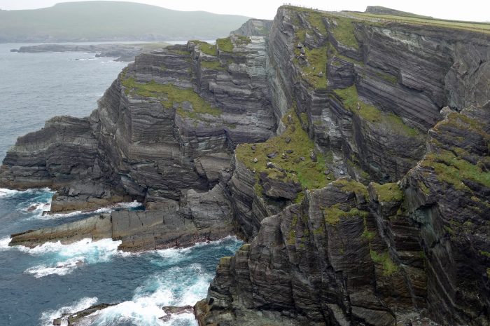
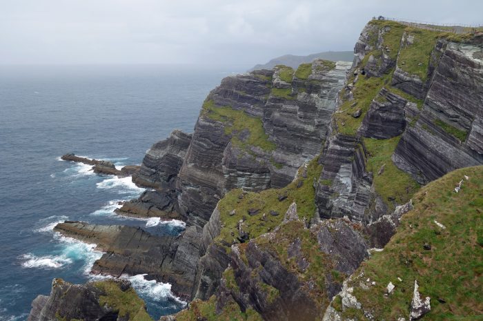
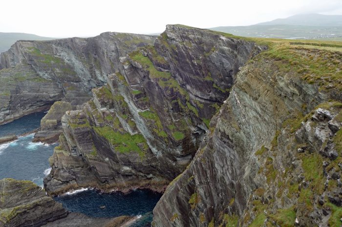
 The Kerry Cliffs
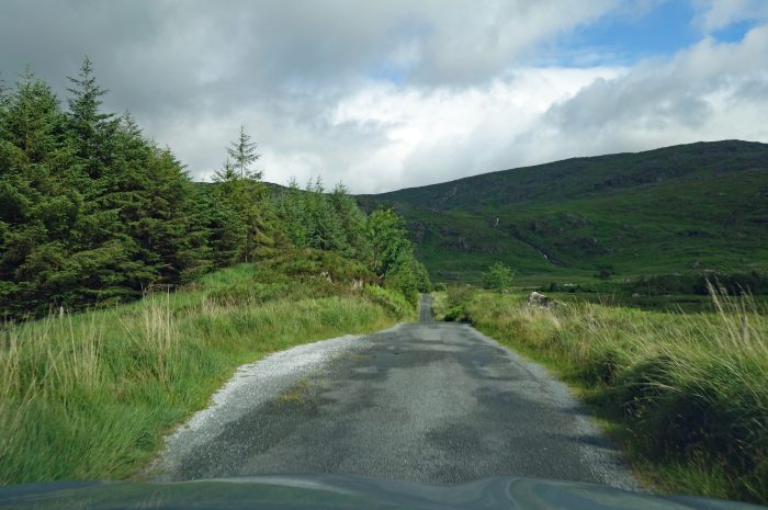
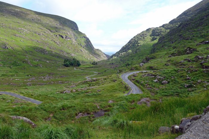
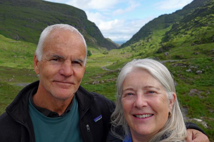
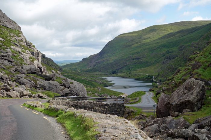
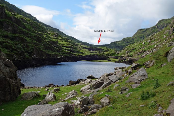
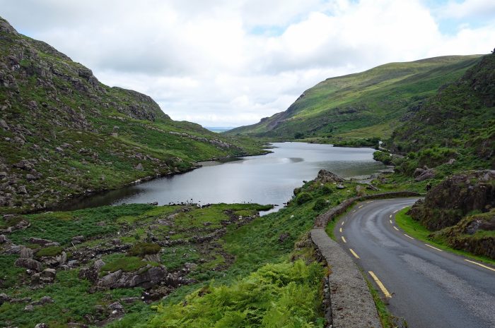
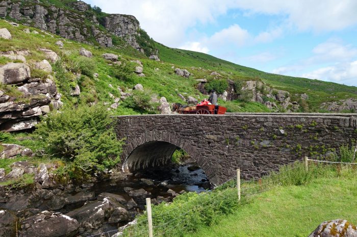
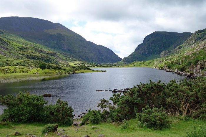
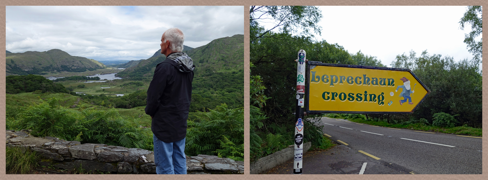
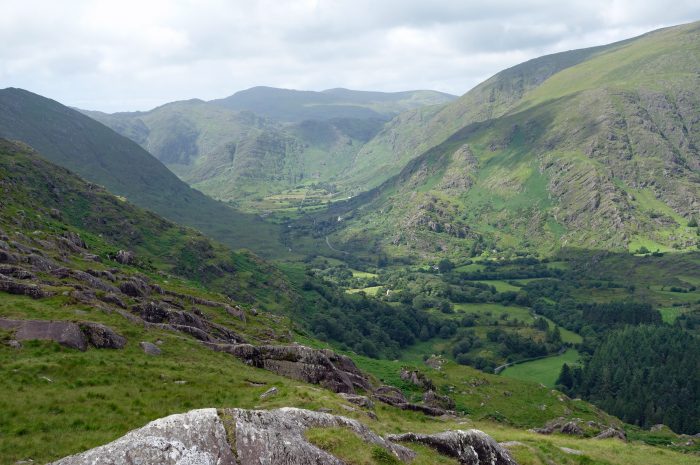
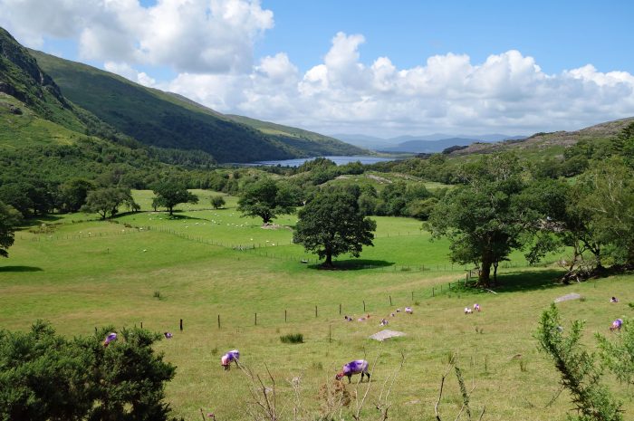
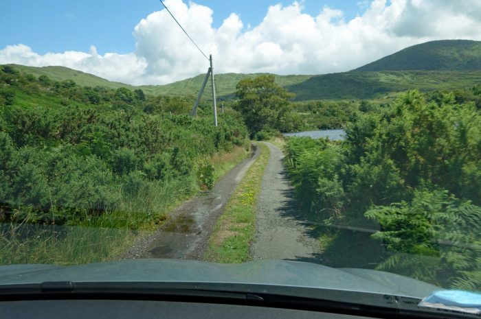
The GAP OF DUNLOE (Dún Lóich) is a spectacular narrow pass through the mountains in County Kerry. We came at it a different direction than most people…..go figure!! Generally, people come from Killarney and approach the gap from the North only going a short distance to the Wishing Bridge. We came from Kenmare, left the main road at Molls Gap, ending up on a single lane road winding through the bottom of the valley before climbing sharply up the edge of the Black Valley to the Head of the Gap of Dunloe. Thankfully we saw very few vehicles, but it was slow going never knowing what was around the next bend in the road. It was all worth it though when we got to the Head and saw the magnificent views laid out before us, and nobody around!! We were very lucky this particular morning with some intermittent sun shining down the valley. Continuing down into the gap we began to see more and more people and quite a lot of “jaunting cars” which are basically a horse drawn buggy holding 4 to 6 people.
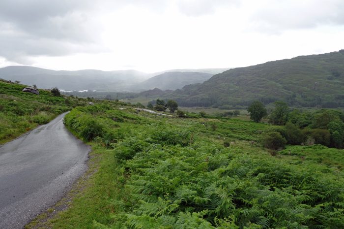
- Our journey along the narrow valley road below Moll's Gap
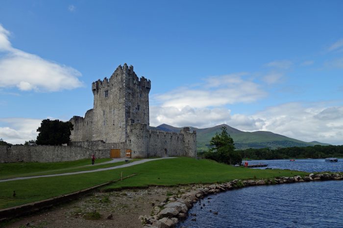
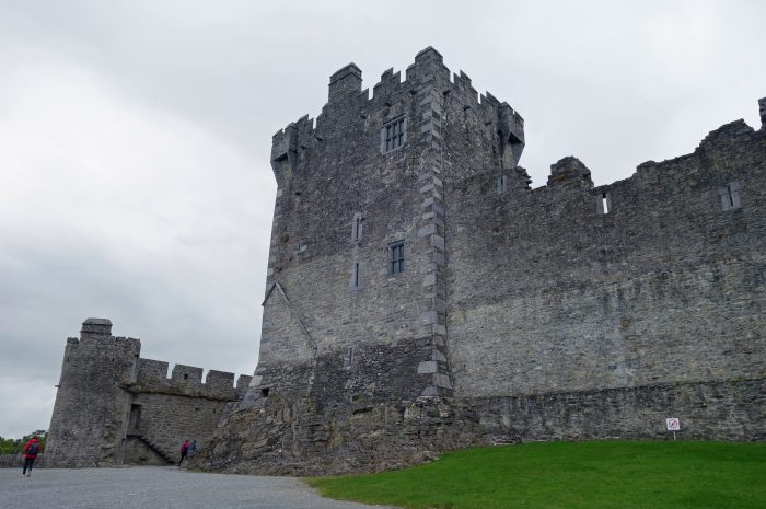
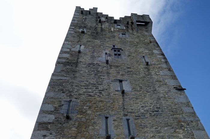
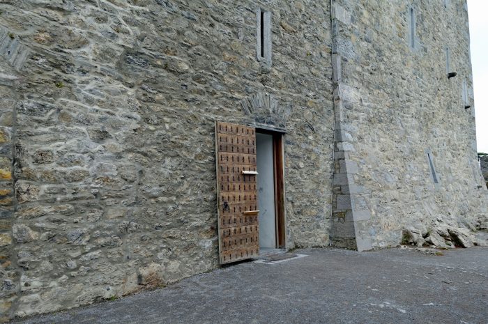
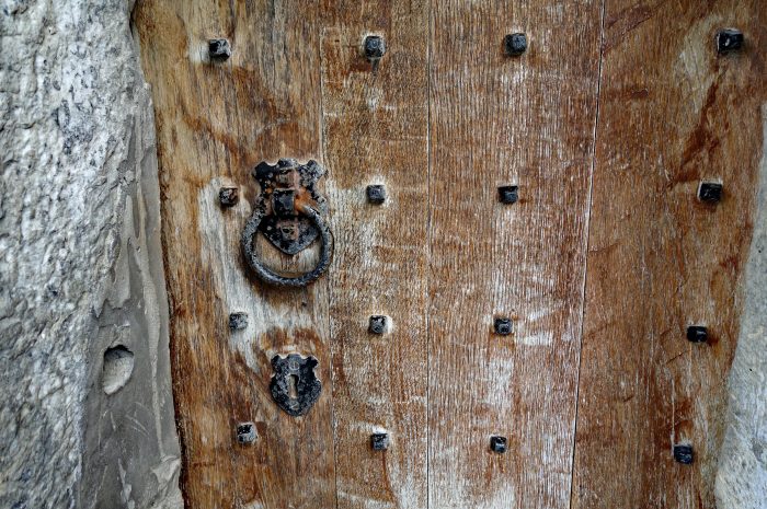
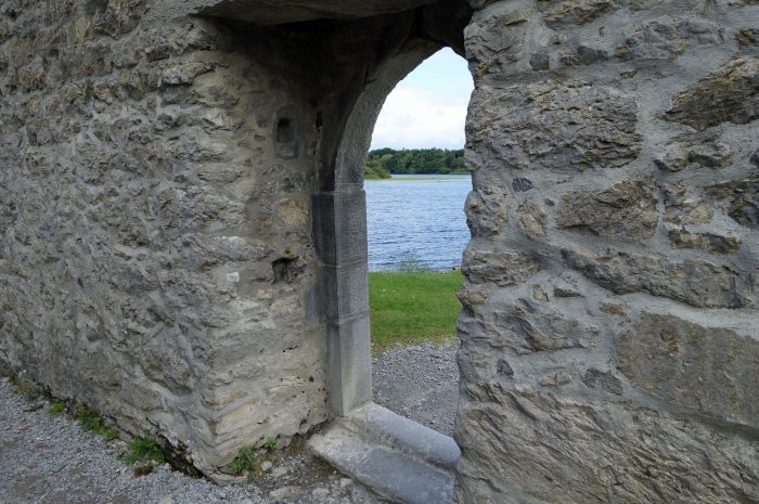
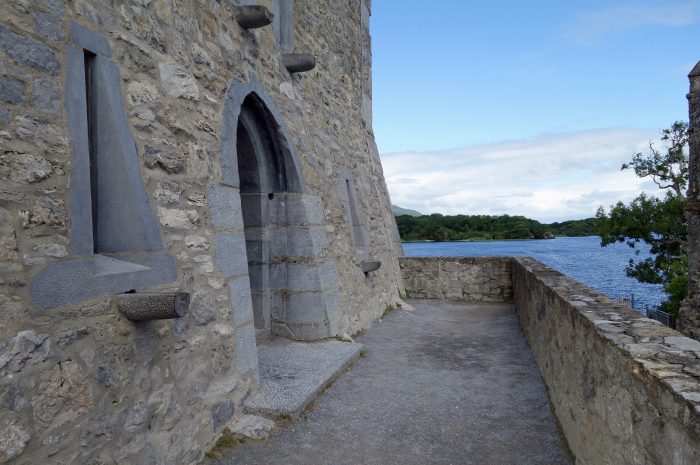
Exiting the Gap of Dunloe we passed through the town of Killarney on our way to ROSS CASTLE (Caisleán an Rois), perched on the edge of Lough Leane in Killarney National Park. The tower and keep was built in the 15th century by the O’Donoghue Clan who ruled the Killarney area at that time. The castle changed hands a few times, was attacked a few times, became a garrison in the 18th century, abandoned in the 19th century and fell into serious disrepair. The castle has undergone major restorations and the only way to see inside is to join a guided tour for 5 Euros ($5.50 USD) per person. The tours were full when we visited but we were able to walk the grounds and visit the interpretive center inside the castle.
- Ross Castle
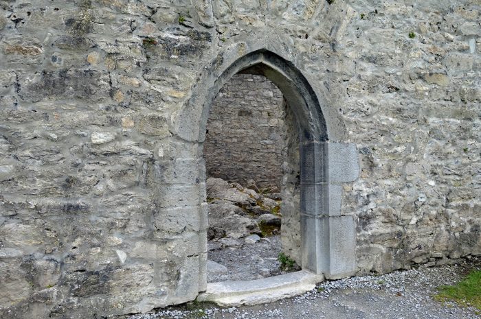
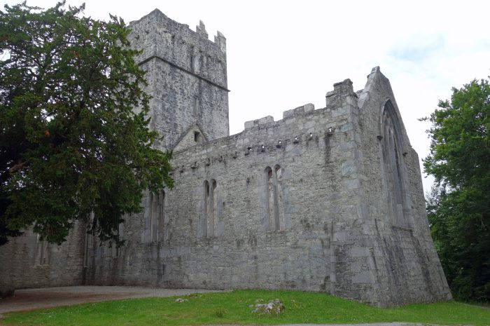
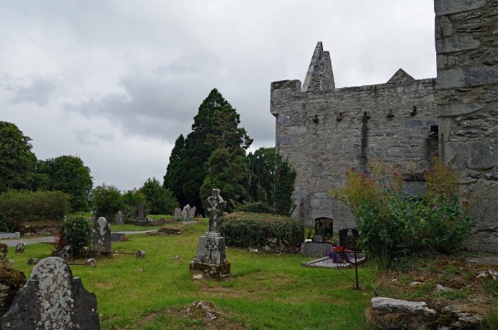
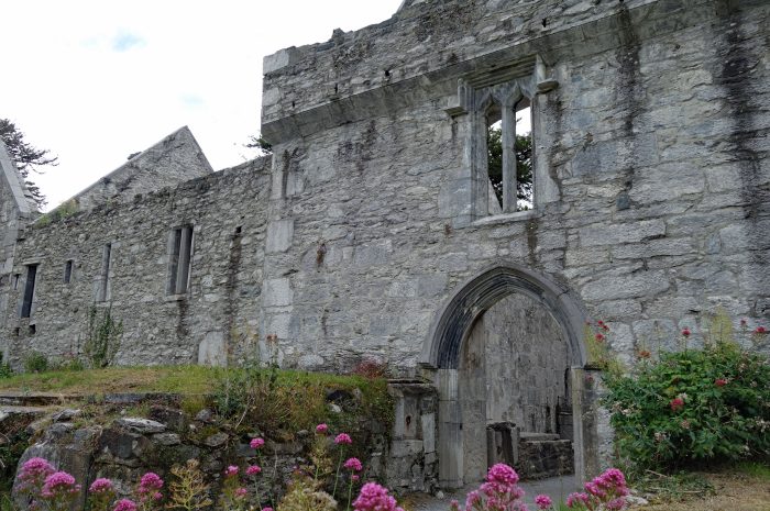
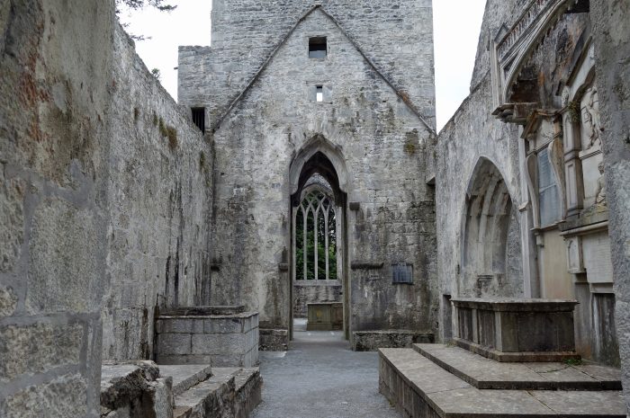
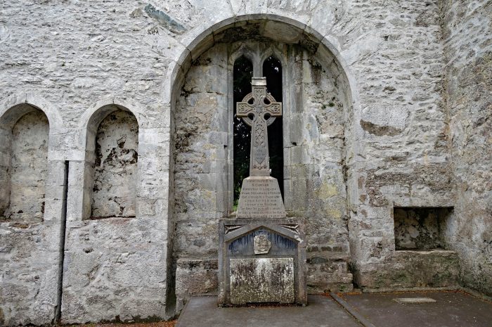
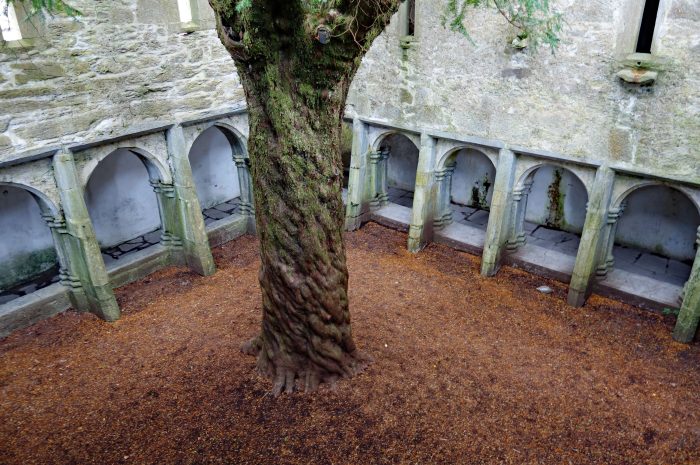
From Ross Castle we drove just a few minutes away to MUCKROSS ABBEY (Mainistir Mhucrois) in the middle of Killarney National Park. The abbey is an old Franciscan friary founded in 1448 with a violent history, being damaged and rebuilt many times. The friars were often subjected to raids by marauding groups, eventually persecuted and driven out in 1652 by Cromwellian forces. It’s most striking feature is the central courtyard, which contains a large yew tree surrounded by a vaulted cloister. The abbey is in surprisingly good condition and we were able to climb up and around the entire complex. The graveyard is still used today and said to hold the remains of the O’Donoghue chieftains.
- Muckross Abbey
Not far from Muckross Abbey is TORC WATERFALL (Easach Toirc), a 5 minute walk from the parking lot alongside the road. A lot of tour buses stop here so the path to the falls is very busy, but fortunately it’s a short walk, you take a few pics and leave. There is nothing else to see or do here unless you wish to continue climbing up the rock stairs to a viewpoint overlooking Killarney Lakes and to the top of the waterfall. Personally, the top of a waterfall is not that impressive!
Continuing the loop back towards Kenmare our next stop was LADIES VIEW, and as the name suggests, it’s a scenic viewpoint on the Ring of Kerry route overlooking the Killarney Lakes. There is a small car park and café so we stopped for coffee and a scone while admiring the views.
Our final stop on our way home was at MOLL’S GAP (Céim an Daimh), another viewpoint on the Ring of Kerry not far from Kenmare. There is a café and gift shop here as well so we had a look around and ended up buying some Skellig Chocolate, we drove past the factory a few days ago on our way to Portmagee and forgot to stop🙄
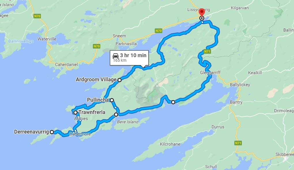
A few locals we talked to recently recommended we drive the Beara Peninsula. They said it’s prettier than the Ring of Kerry drive and with less people, so off we went! Our first trip took us from Kenmare, south towards Glengarriff, west to Adrigole, up and over the Healy Pass, the back towards Kenmare with a side trip to Gleninchaquin Park. A 95 km route stopping at a few places along the way:
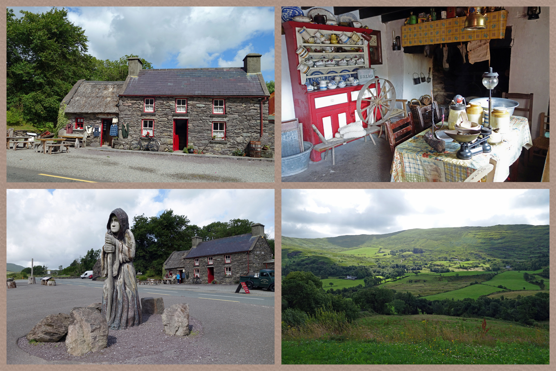
MOLLY GALLIVAN’S COTTAGE is a 200 year old stone cottage and traditional farm. The legendary Molly Gallivan was widowed with seven small children and became very resourceful to keep her family alive. She sold produce from her farm, home baking and hand spun woolens but it was her illicit home made whiskey that she sold in her illegal pub that was most profitable! In front of the cottage is The Druid, an imposing carved figure representing the first settlers to arrive in Bonane more than six thousand years ago. The Druid looks over a stunning valley to the Barra-Bui peak.
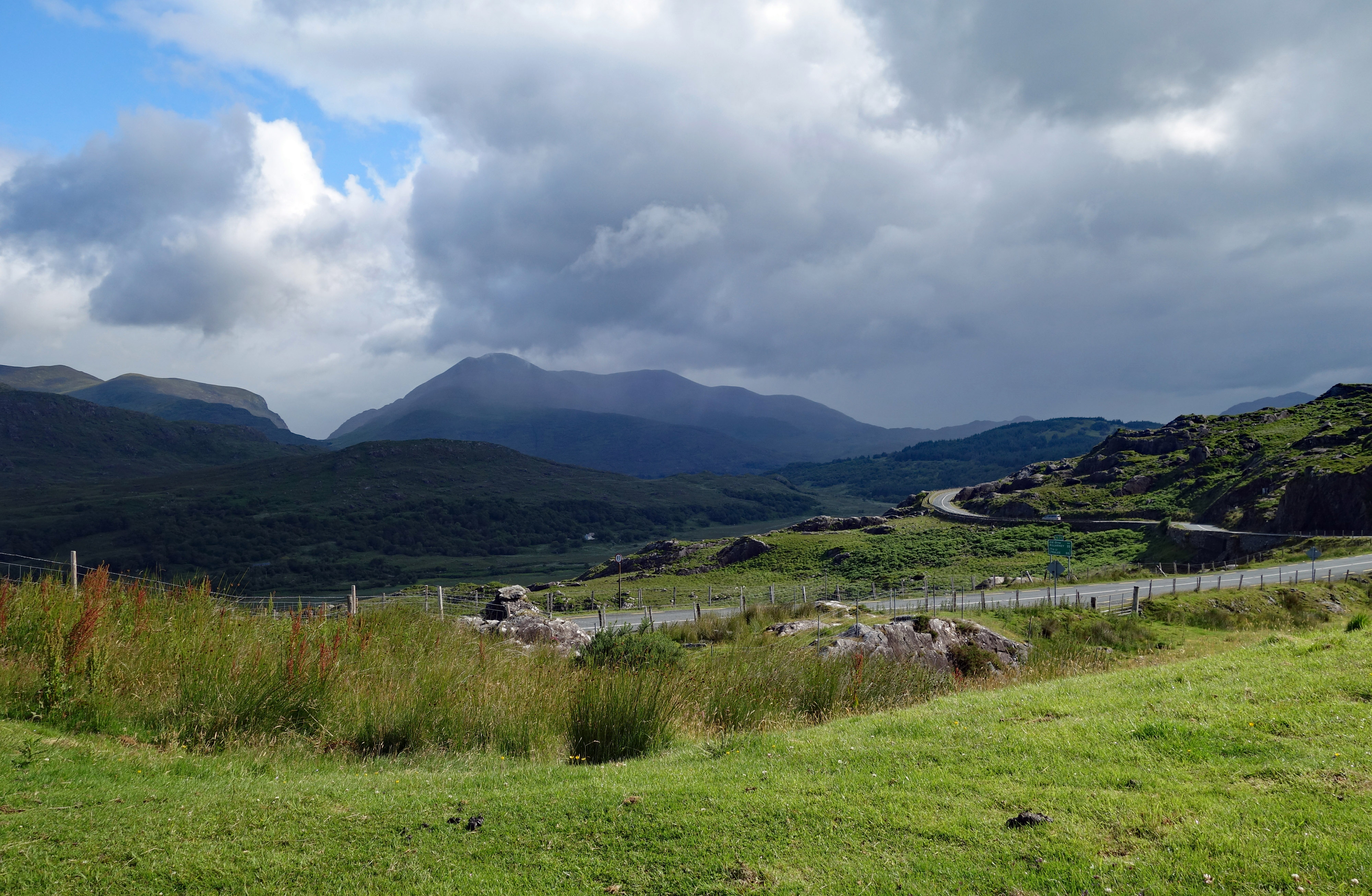
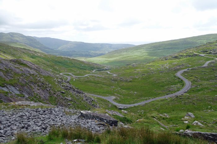
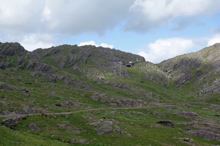
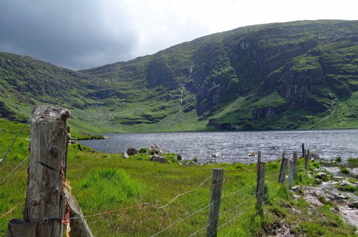
The weather was pretty good (ie not raining!!) so we decided to cut across the Beara Peninsula over the HEALY PASS (Bealach Scairte) which overlooks GLANMORE LAKE. It’s another twisty, narrow road but oh my, the views at the top are stunning. The pass straddles the border between County Cork and County Kerry so you can see both counties from the top. The road was built in 1847 during famine times ostensibly to help prevent starvation, however there are many stories of workers dying of starvation. Famine roads are common in Ireland being part of the Conservative Government’s initiatives to improve Ireland’s infrastructure and provide employment for those who had lost their income as a result of the failure of the potato crop in 1845. The scheme was beset with problems, bad management, the lack of tools, and the physical condition of the workers because of malnutrition.
- The Cork side of Healy Pass
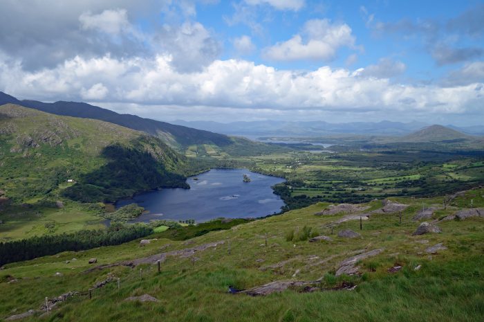
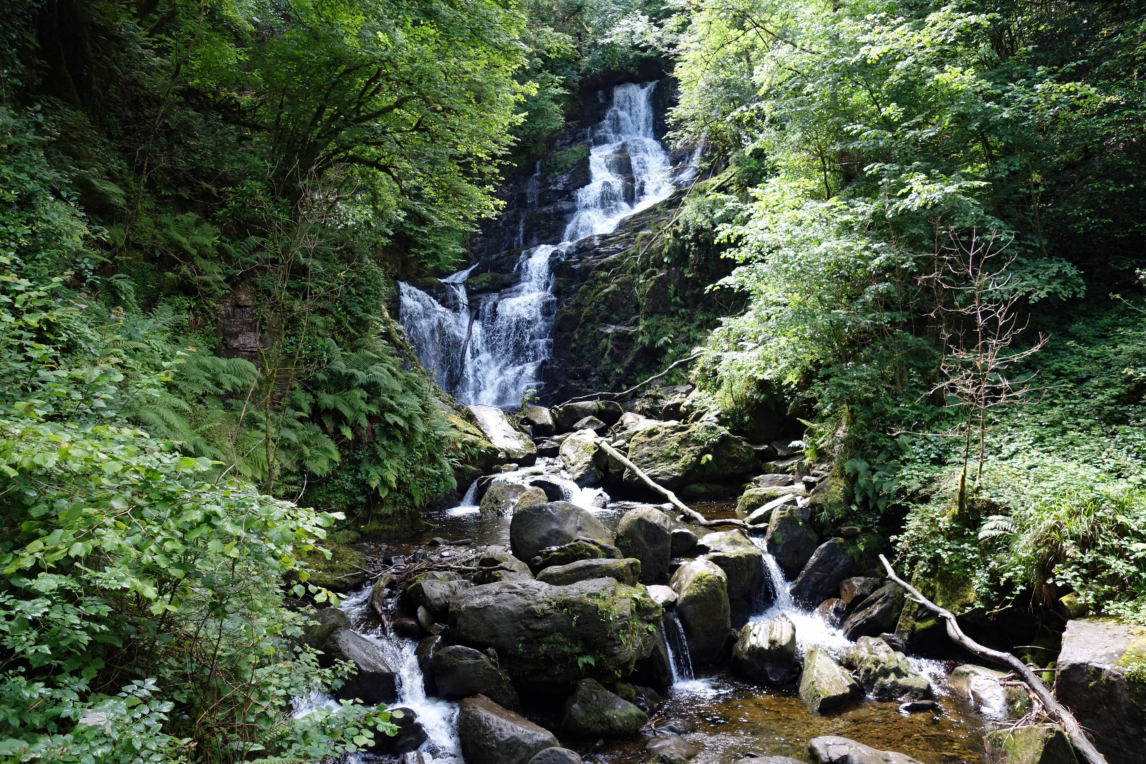
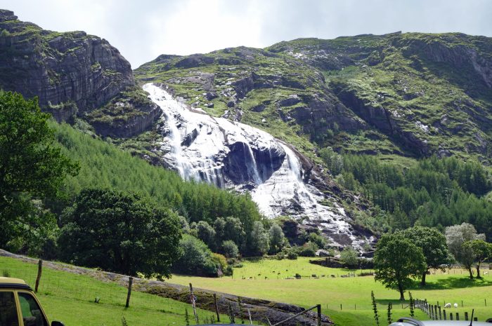
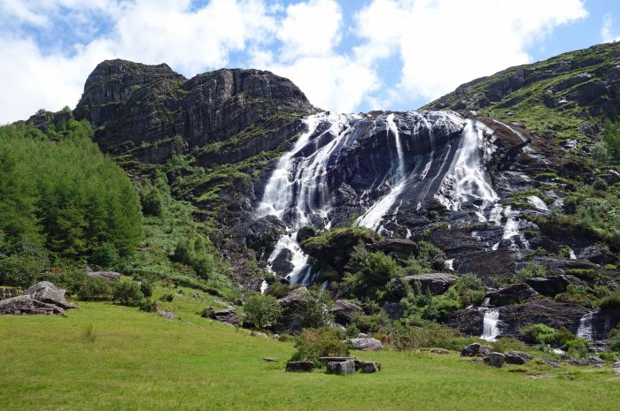
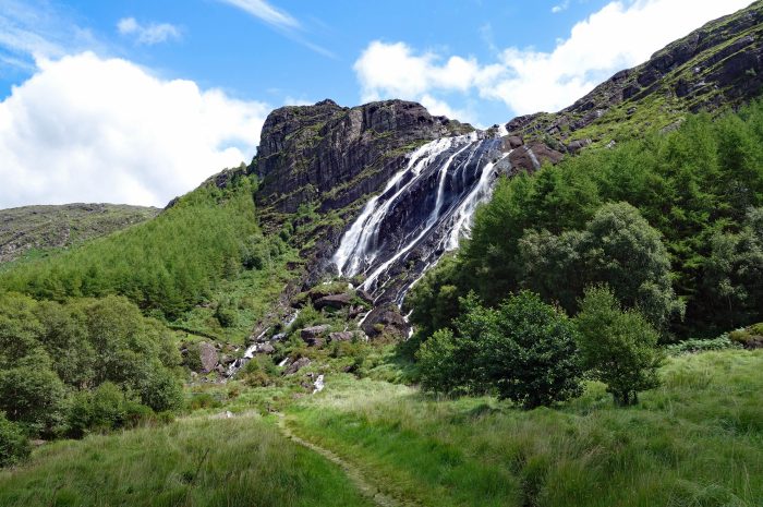
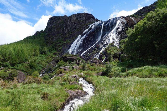
Descending Healy pass we turned towards Kenmare, heading to GLENINCHAQUIN PARK to view the waterfall. This park is situated on a private, you guessed it, sheep farm!! The road to get here is an 8km long single lane track which can be pretty stressful when meeting an oncoming car!! The park is very organized with marked trails ranging from 40 minutes to 7 hours for the serious hiker. We were specifically interested in the falls so opted to do a section of the 90 minute walk which took us under the falls and as far as Cummeenadillure Lough before we turned back. Blair considered doing the full route, but the rain clouds were forming and it started to sprinkle (there are a lot of words in Ireland to describe the various levels of rain 😂) so we made our way back to the car. The cost to access the park was 7 Euros (USD $7.80) each.
- Gleninchaquin Falls
We drove the Beara Peninsula a second time, doing the entire route covering 165 km. Once again, there was a lot of driving involved for what we considered not much reward. A lot of the road is inland with no views and one can visit only so many “quaint” towns with nothing to offer but shopping and restaurants.
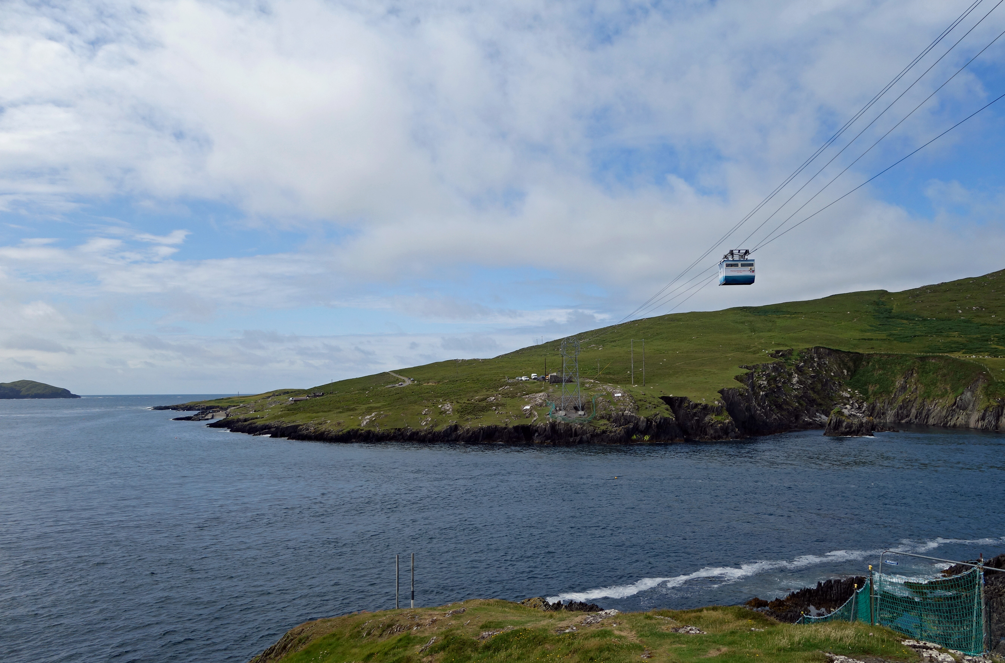
We drove to very end of the peninsula to take a look at the Dursey Island Cable Car, Ireland’s only cable car and the only cable car that crosses open seawater in all of Europe. The tides race through the narrow Dursey Sound making it treacherous to cross by boat, in bad weather the islanders used to be cut off for weeks. There is nothing much on the island so we did not take the cable car over there.
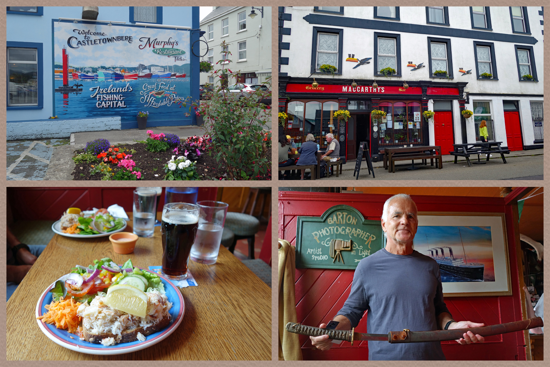
From Dursey Island we headed to Castletownbere, and specifically to MacCarthys Bar, on the recommendation of the lady at the Kenmare tourist office. Castletownbere is a working fishing port where most of the fish served in local restaurants is landed. MacCarthys Bar has been in the family since 1860, currently being run by the great-granddaughters of the founder. One reason it attracts tourists is the Japanese Ceremonial Sword brought back from WWII by Aidan MacCarthy. Here is the horrific story of what Dr Aidan MacCarthy endured as a POW during WWII and how he came to have the ceremonial sword.
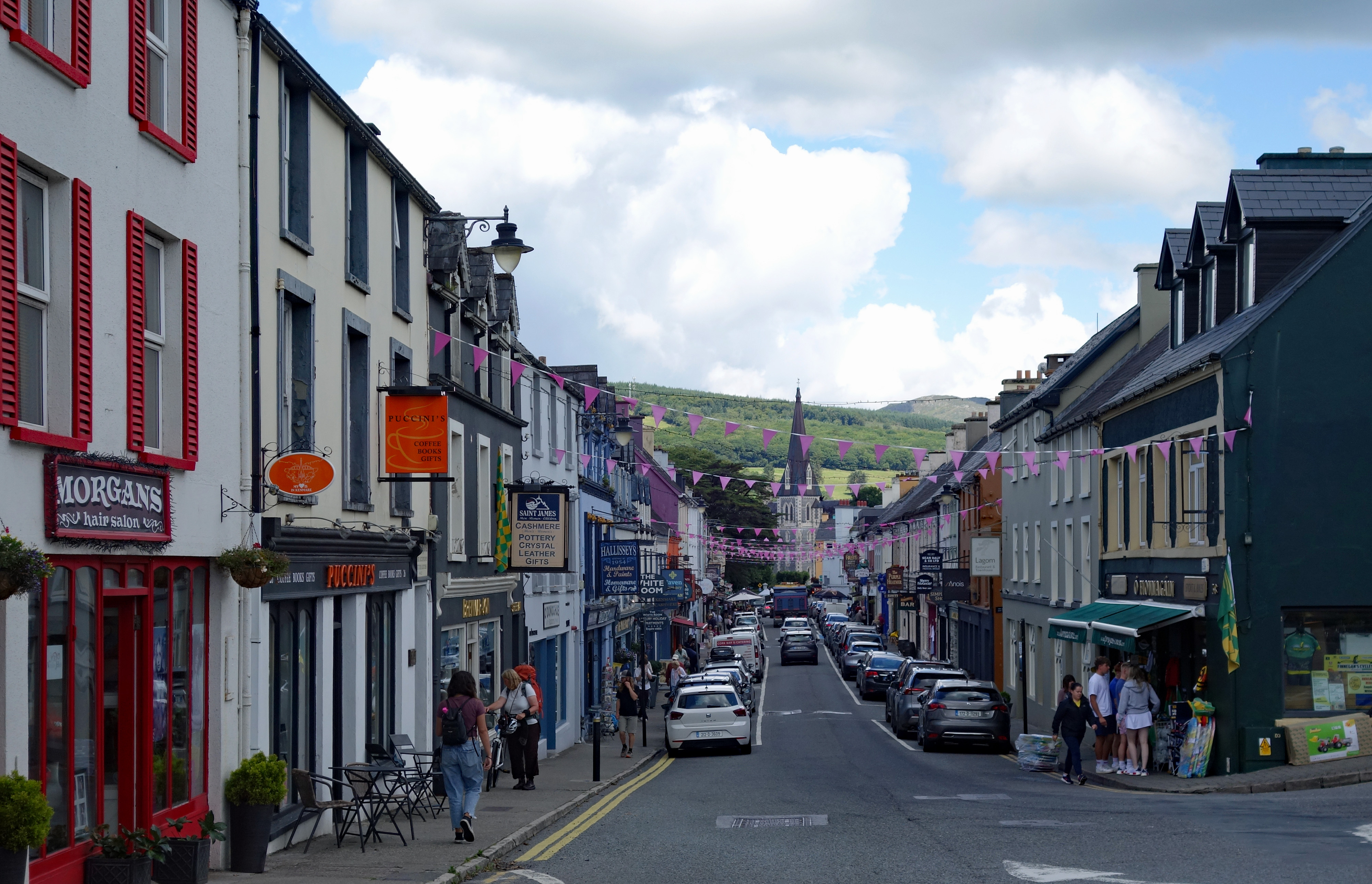
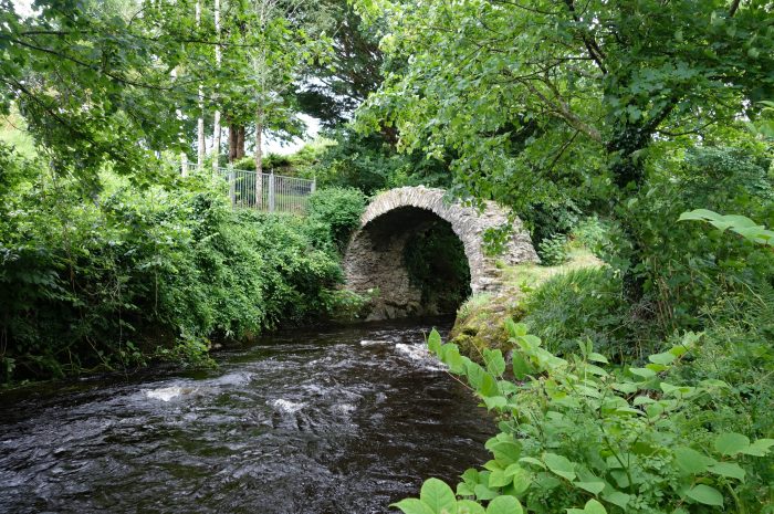
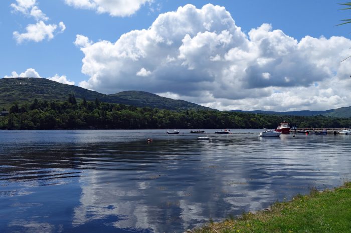
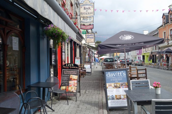
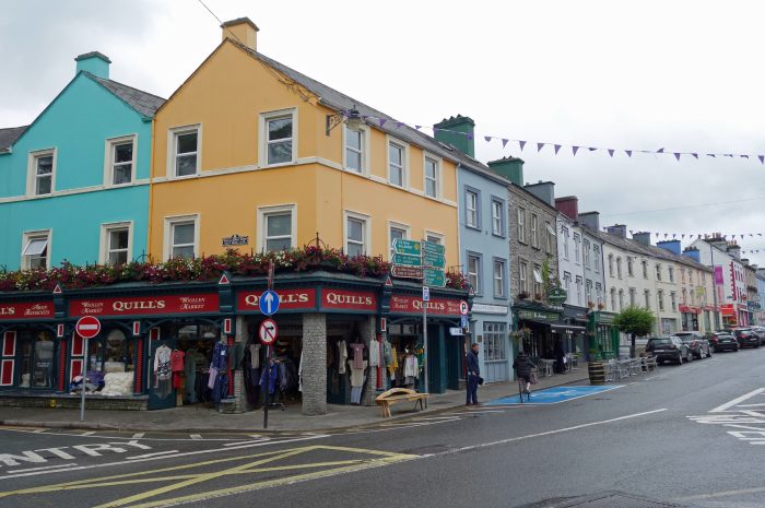
KENMARE (Neidin) is located at the head of Kenmare Bay at the junction of the Iveragh Peninsula and the Beara Peninsula and is a much quieter place to stay than Killarney. Our Airbnb was walking distance from town so we took many a stroll along the three main streets which are filled with pubs, restaurants, cafes and shopping. The shopping is fabulous in Kenmare so you can find pretty much anything you are looking for all in just a few streets. Around town we found Cromwell’s Bridge, thought to be built in the 7th century by Franciscan monks, and the Kenmare Pier with beautiful views over the bay and surrounding hills. Very pretty on a sunny day!
- Cromwell's Bridge
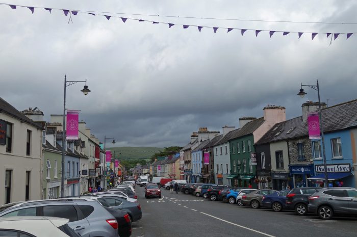
Final thoughts on Kenmare: It’s a really good location to base yourself to tour the various peninsulas in the area. The town is much quieter than Killarney, yet not lacking in amenities such as great restaurants, numerous pubs and shopping. The drives are long, but that would be the case with anywhere you stayed near here because the roads around the peninsulas cover a lot of miles. The weather is very unpredictable (and has been for the past 29 days) you just have to get out and take your chances. In most cases the rain does not last very long, unless it’s just one of those really awful days when it rains all day long! On those days, we found a lovely gym at the Kenmare Bay Hotel to get in a good workout. Of our 10 days in Kenmare, it rained every single day!!! But not all day, we had a lot of cloud cover and once in a while the sun peeks out, which is when I take my photos so of course you are going to think we had nothing but fabulous weather 😂😂
After almost a month at the southern end of Ireland we now head north up the west coast towards Doolin and the Cliffs of Moher. Fingers crossed for a bit of sunshine, heck I’d settle for no rain at this point…..
An té a bhíónn siúlach, bíonn scéalach
He who travels has stories to tell