Magnetic Island, affectionately known to locals as “Maggie,” is a tropical island located just 8 kilometers off the coast of Townsville in North Queensland. Sitting within the World Heritage-listed Great Barrier Reef marine park, over two-thirds of the island is protected national park. With rugged granite boulders, eucalyptus forests and 23 pristine bays and beaches, its renowned for its laid-back lifestyle and abundant wildlife. There are many walking tracks and viewpoints scattered around the island that we were looking forward to exploring.
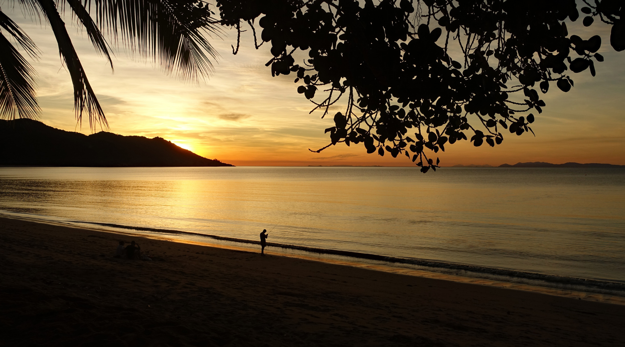
We based ourselves in Horseshoe Bay, the island’s largest bay and a central hub for water activities, dining, and local life. The calm bay is ideal for leisurely beach walks and a variety of watersports activities. Along the waterfront are a few cafes, bars and restaurants serving fresh seafood with front-row views of the sunset.
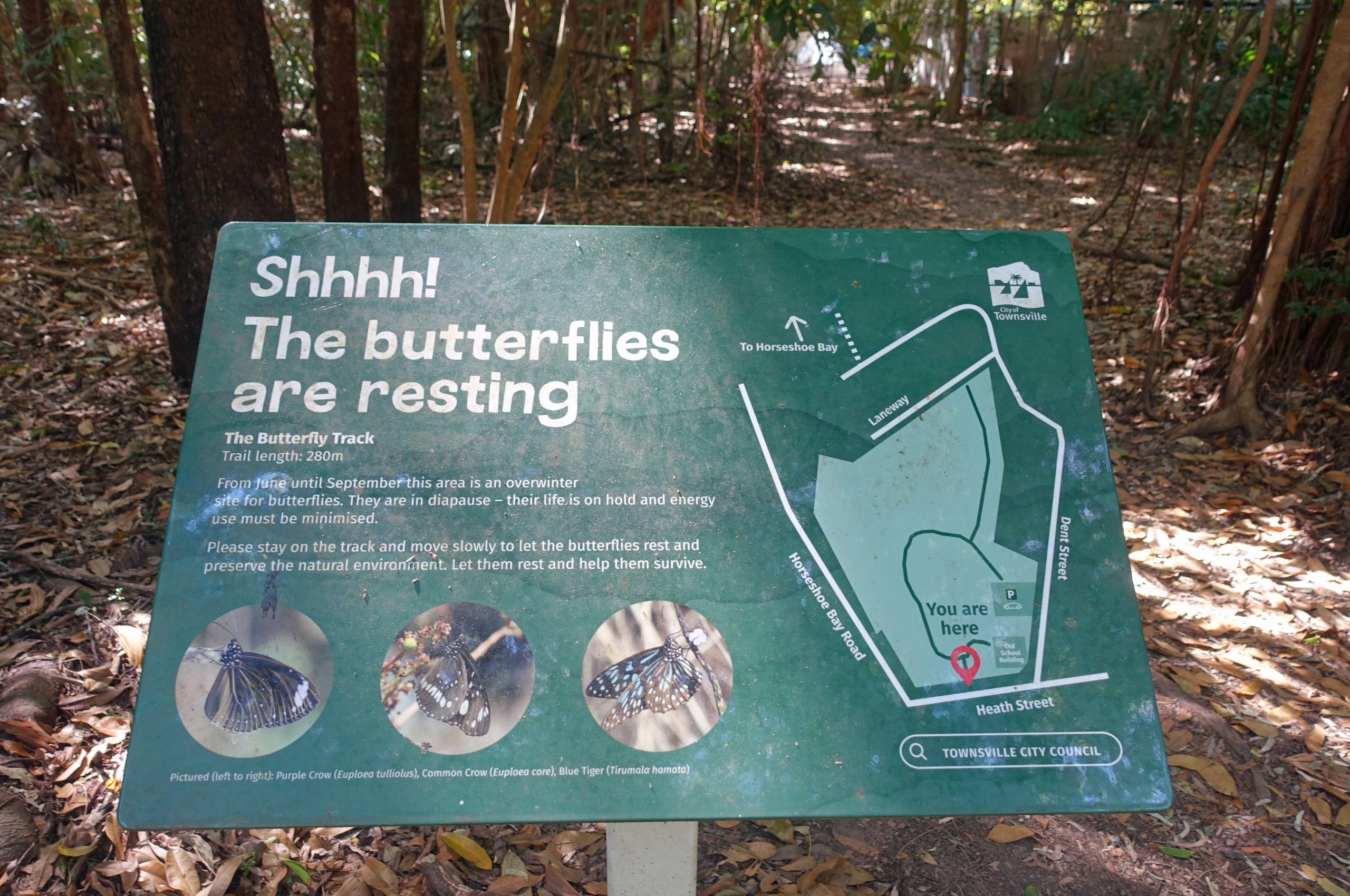
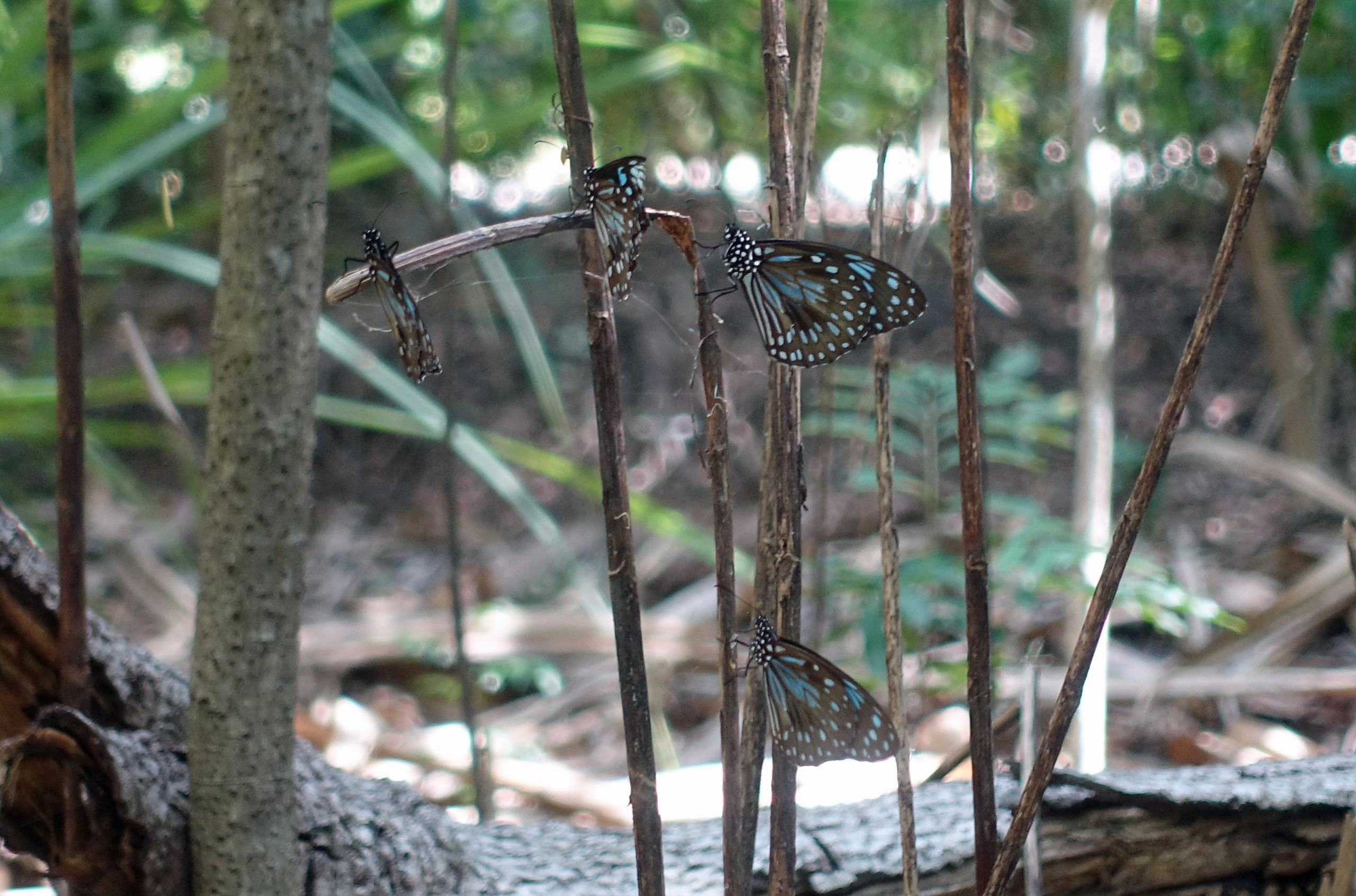
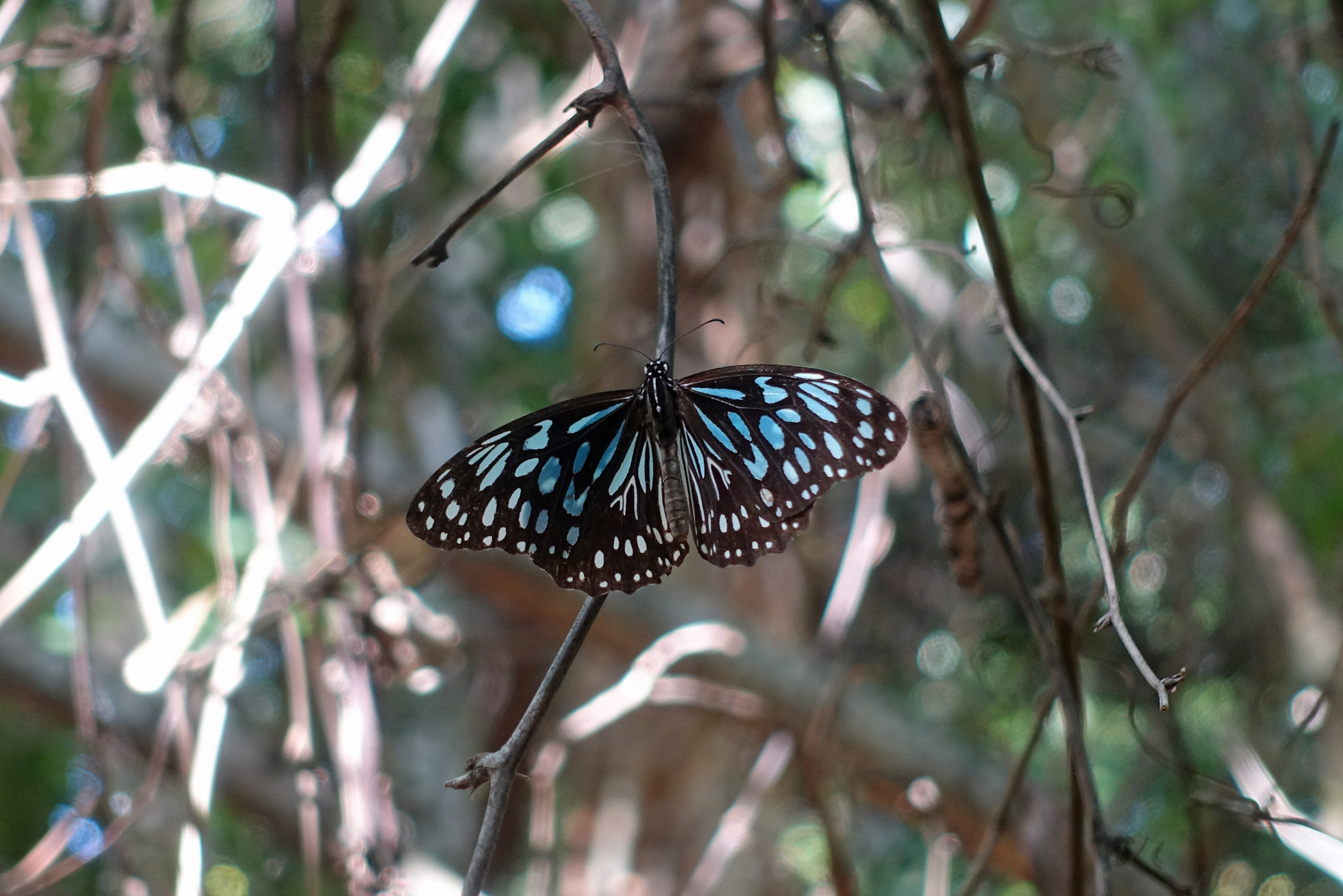
Not far from our apartment was the Butterfly Forest Walk, a short nature trail famous for attracting thousands of migrating butterlies during the cooler months. This area is a seasonal overwintering sanctuary primarily for the Blue Tiger butterfly. We did not see thousands of butterflies as is sometimes possible, but we certainly saw hundreds of them. We also spotted a few wallabies in the forest, and maybe a spider or two. (click on any picture to enlarge)
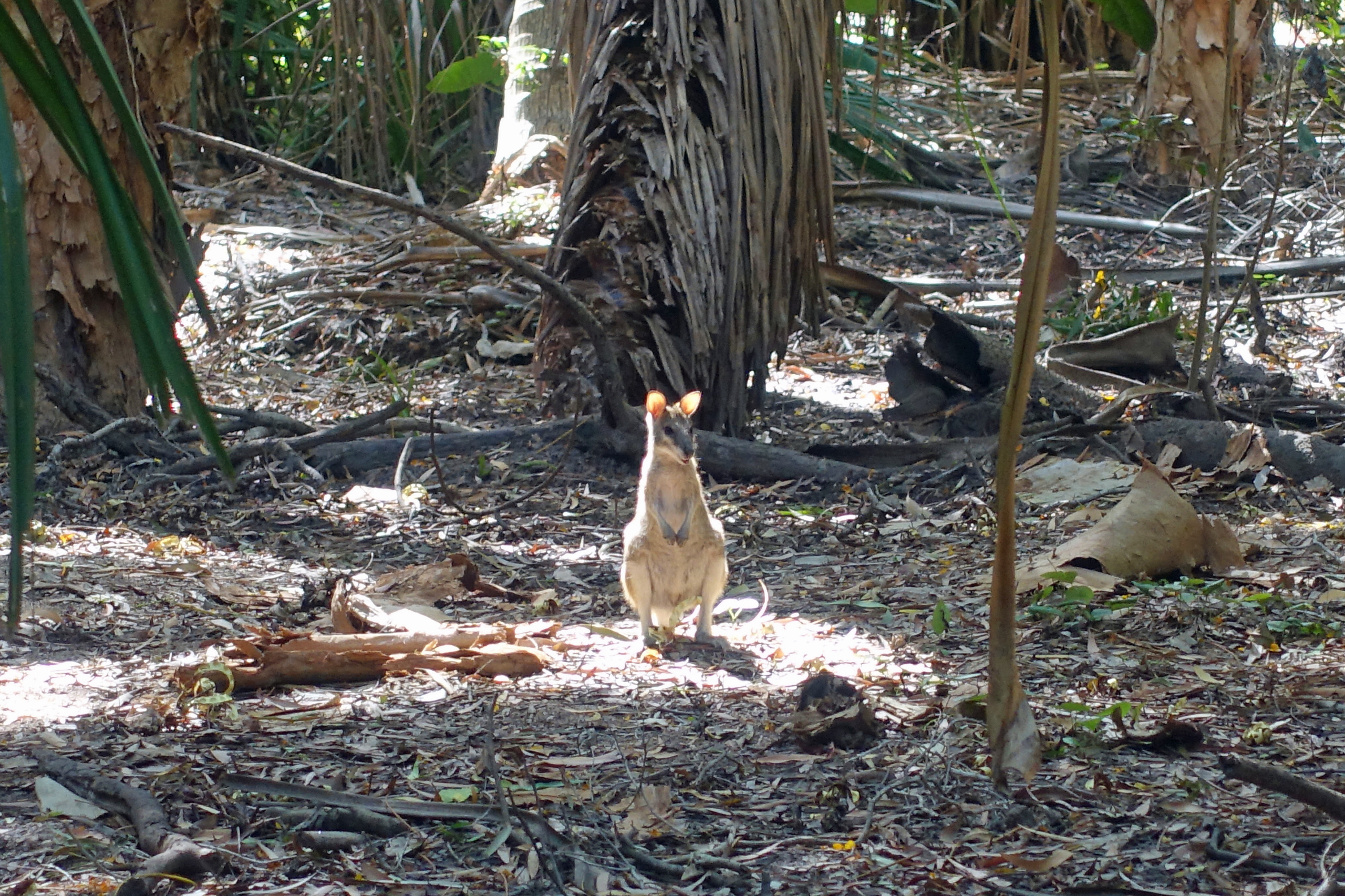


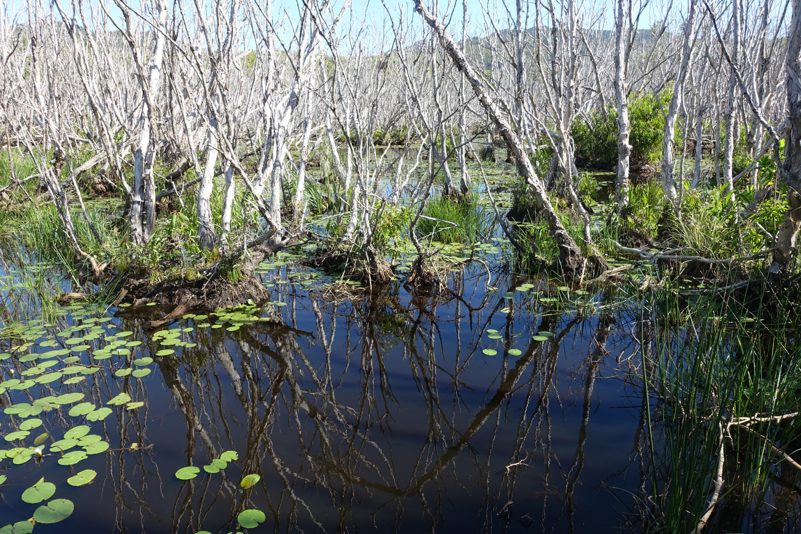
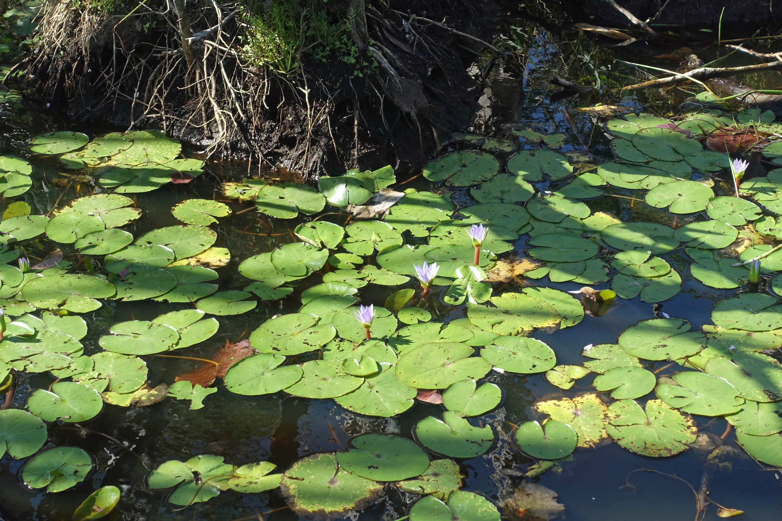
After the Butterfly Forest we crossed the road and went on another walk suggested by our host. It is not marked but the path leaving the road through the forest eventually takes you to an elevated boardwalk over a lagoon filled with paperbark trees. Some of the lilies were starting to flower. We saw a few more wallabies here as well.

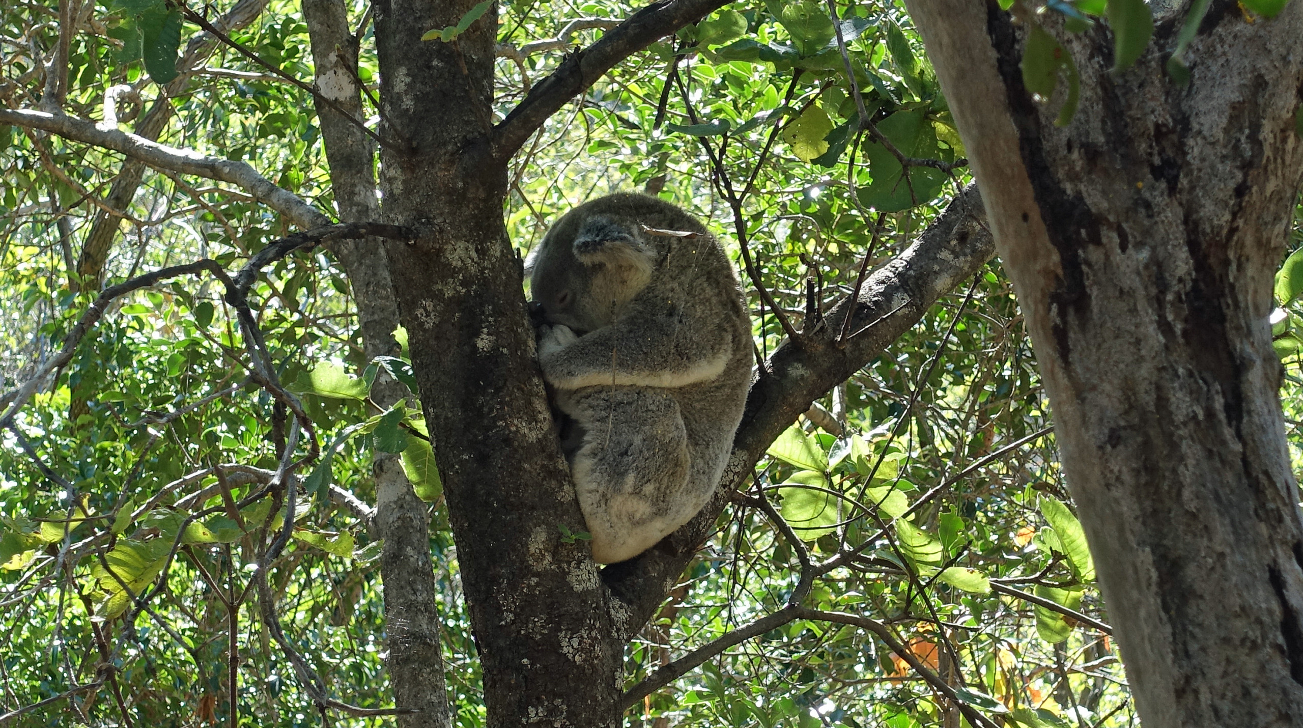
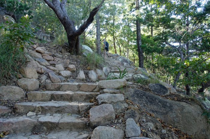
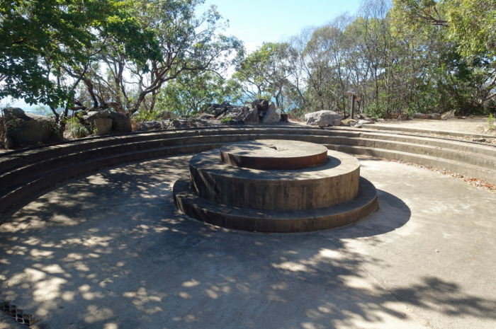
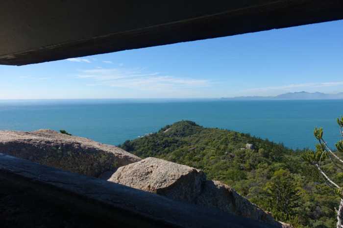
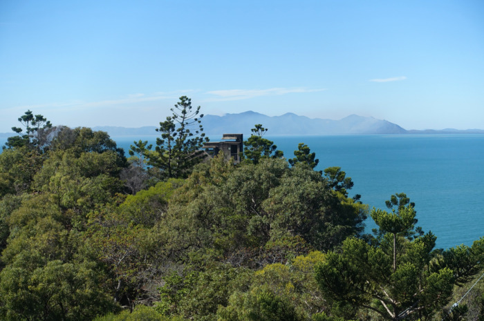
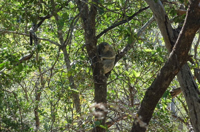
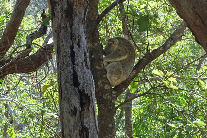
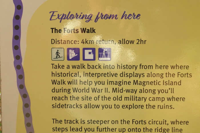
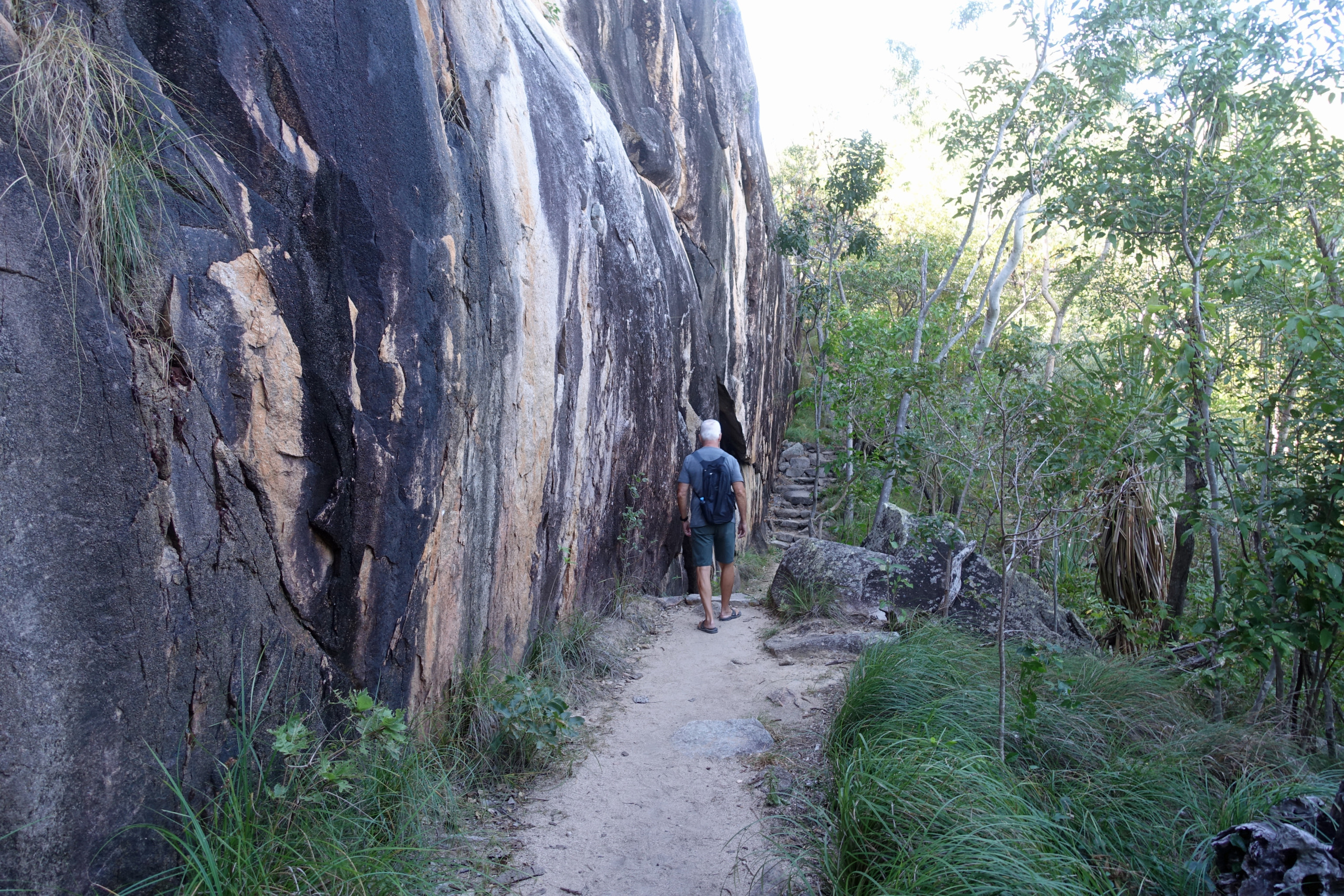
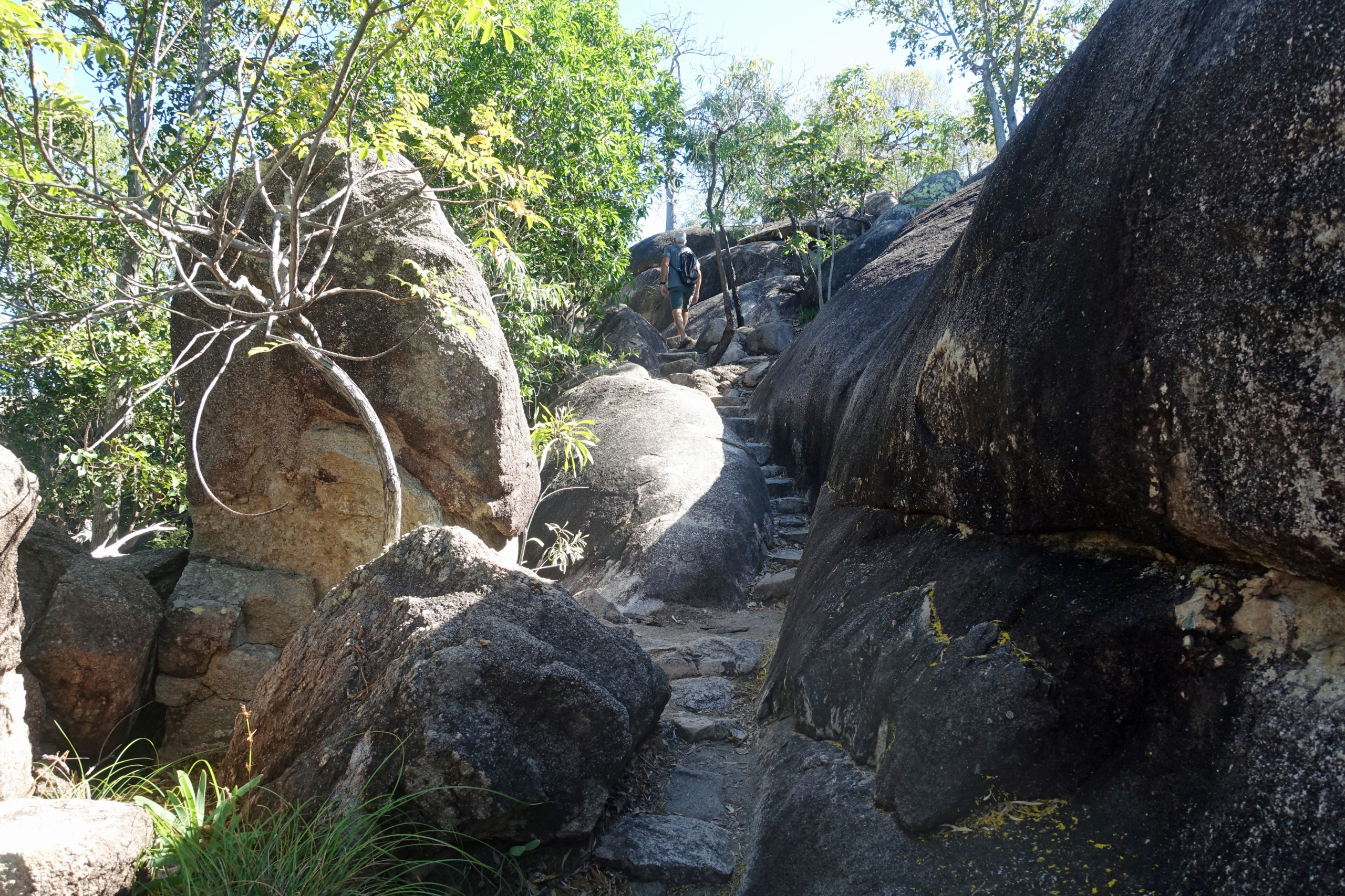
The Forts Walk is the island’s most iconic and most popular hiking trail, weaving through scenic bushland up to historic World War II-era concrete fortifications. The ruins offer a fascinating step back into military history, framing panoramic views across the Coral Sea. The walk is a moderate 4km return trek but with side trips to some of the ruins and historic displays we ended up walking 4.7km. Climbing the stairs of the old observation tower at the top provides an incredible, uninterrupted vantage point over the island’s eastern coastline. However, the main attraction here is koala spotting. This eucalyptus forest is home to Northern Australia’s largest colony of wild koalas, making it one of the best places in the country to spot them resting in the tree forks or high in the branches. I consider ourselves exceptionally lucky to have seen 3 koalas during our walk, not that we spotted them, other hikers shared their location. Only one of the Koala’s was low enough to be worth photographing. We saw a couple of wallabies during our walk but they were deep in the bush. All in all it was a very successful walk through the forest 🐨🦘
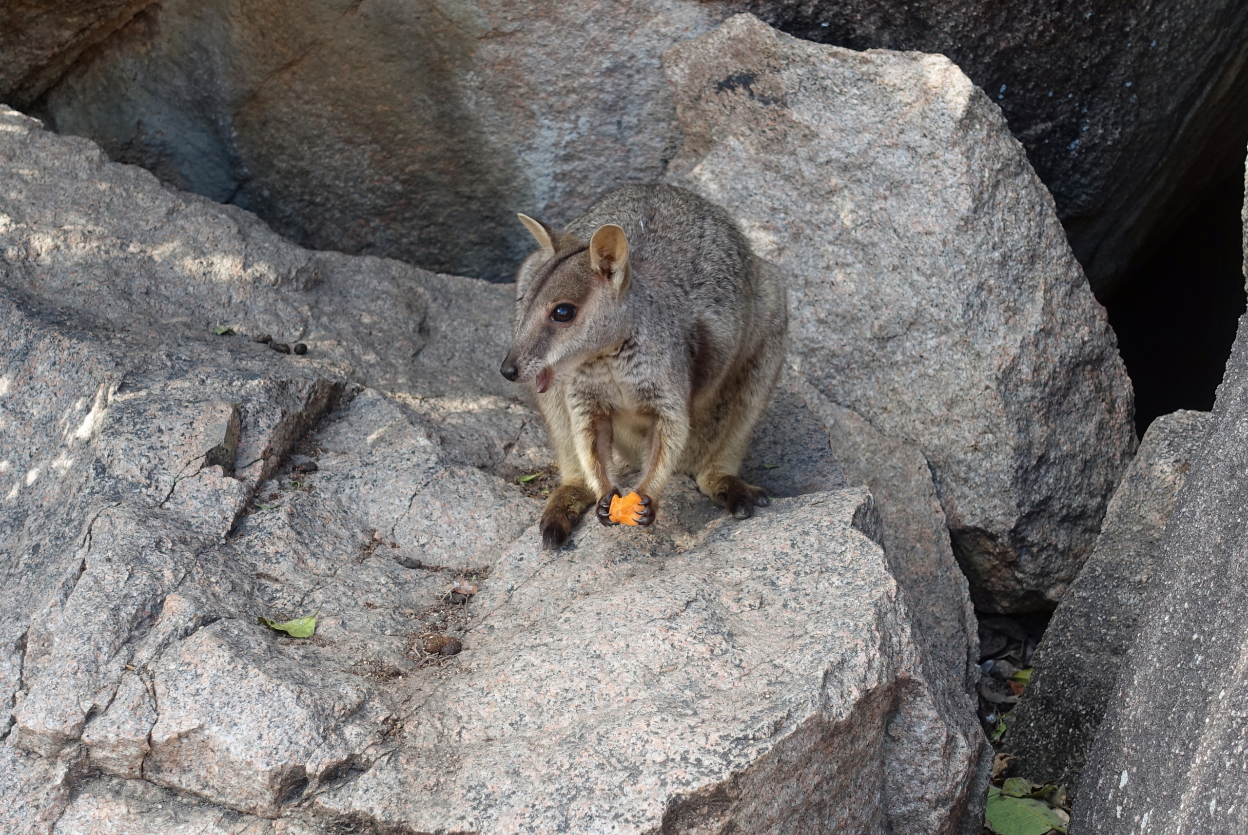
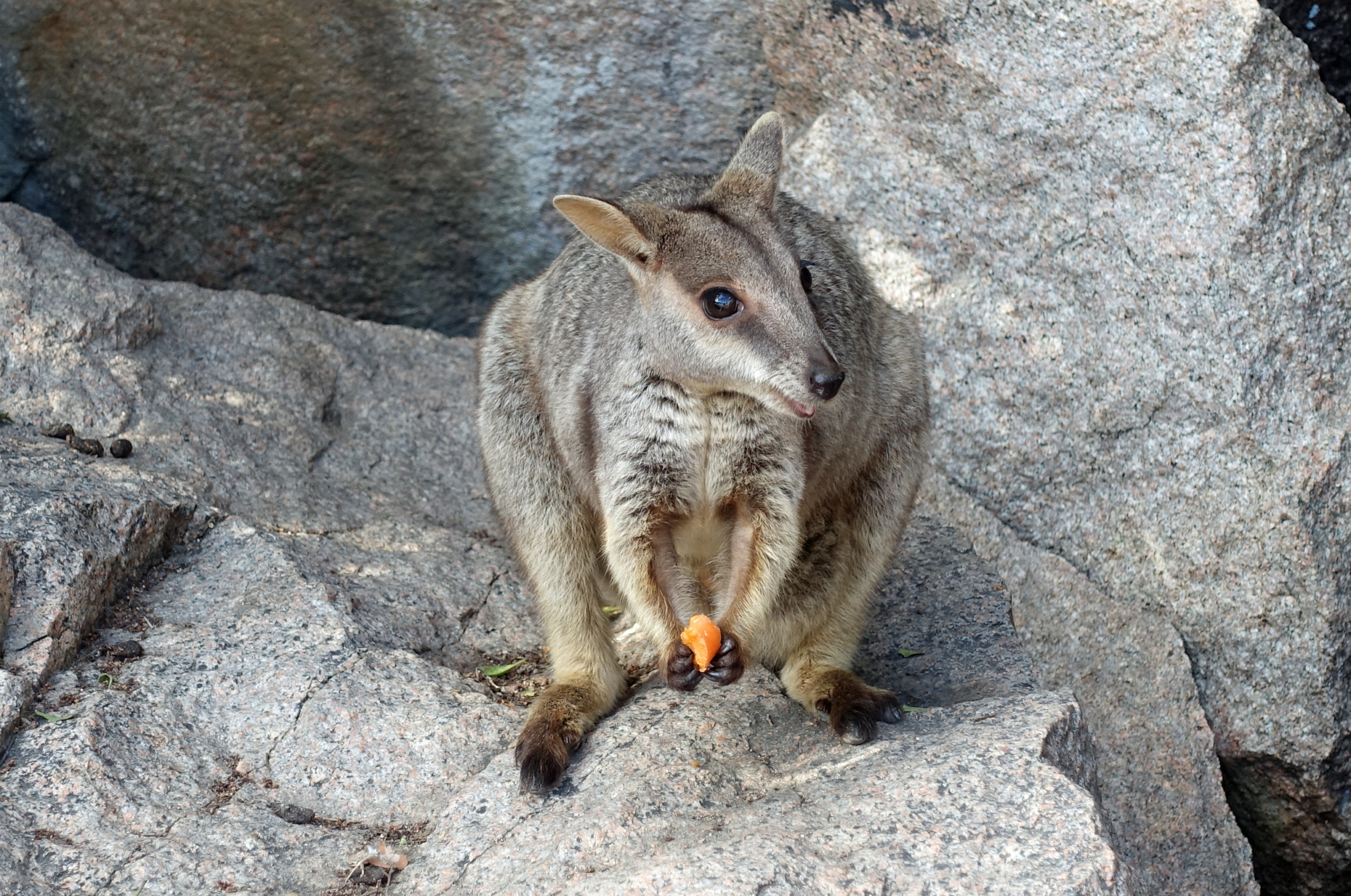
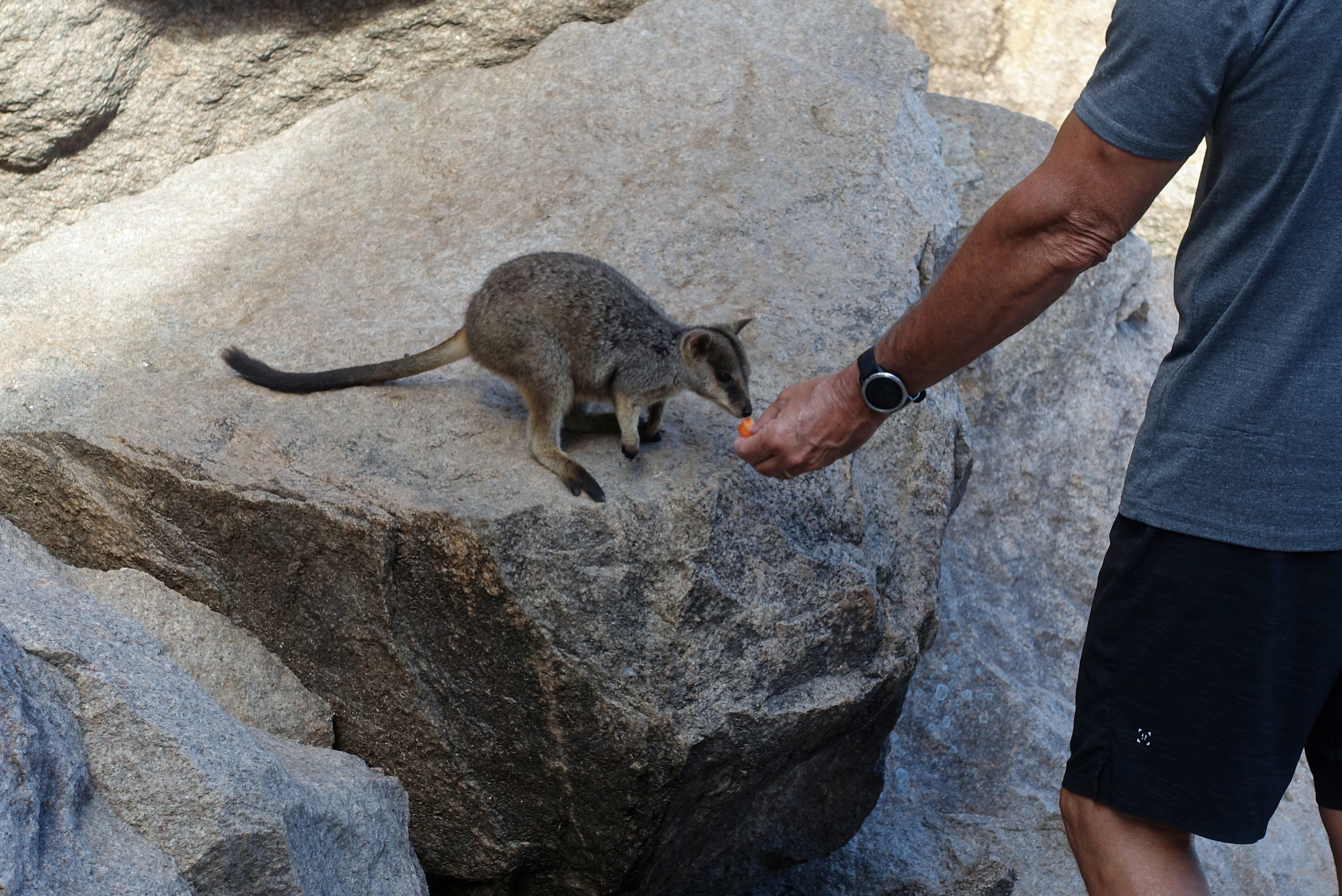
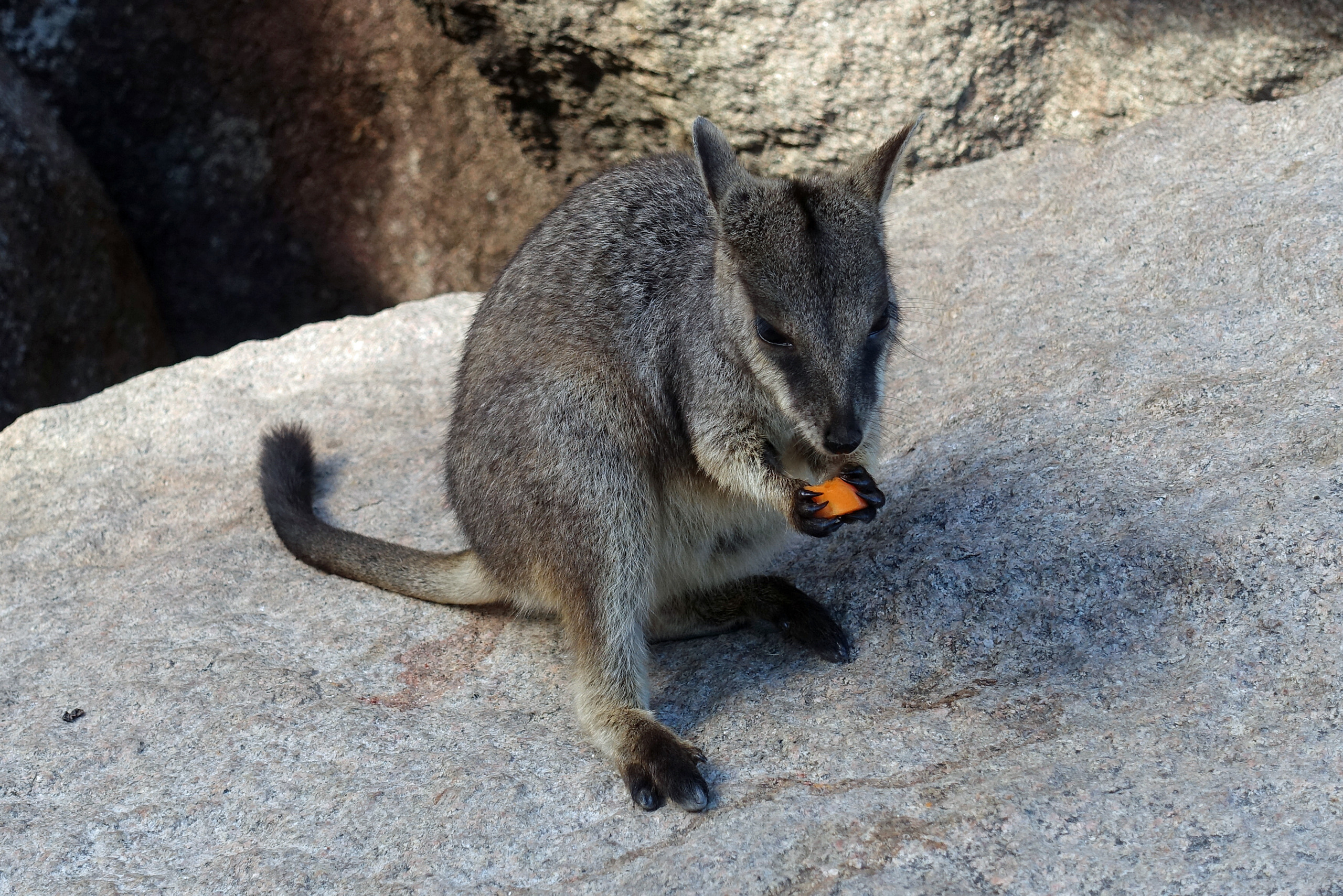
At Bremner Point in Geoffrey Bay, an old jetty road leads into a landscape of massive granite boulders where a resident population of wild Allied Rock Wallabies live. The wallabies are habituated to humans and emerge from the safety of the boulders in the late afternoon, offering an up close wildlife encounter. These very cute marsupials set amongst the giant seaside boulders makes it a favorite destination for photographers.
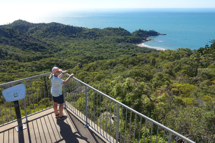
The hike to Hawkings Point Lookout is rated as a Grade 4 walking track, not because its long, but its pretty much straight up and is predominantly steps. The distance is 1.2km return and we took our time stopping periodically to look for Koala’s so we did not find the walk all that difficult. The views from the top over Rocky Bay Beach, Picnic Bay and the pier were well worth the hike.


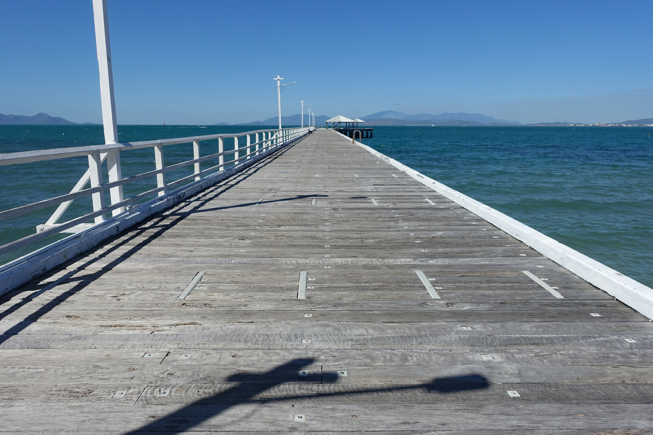
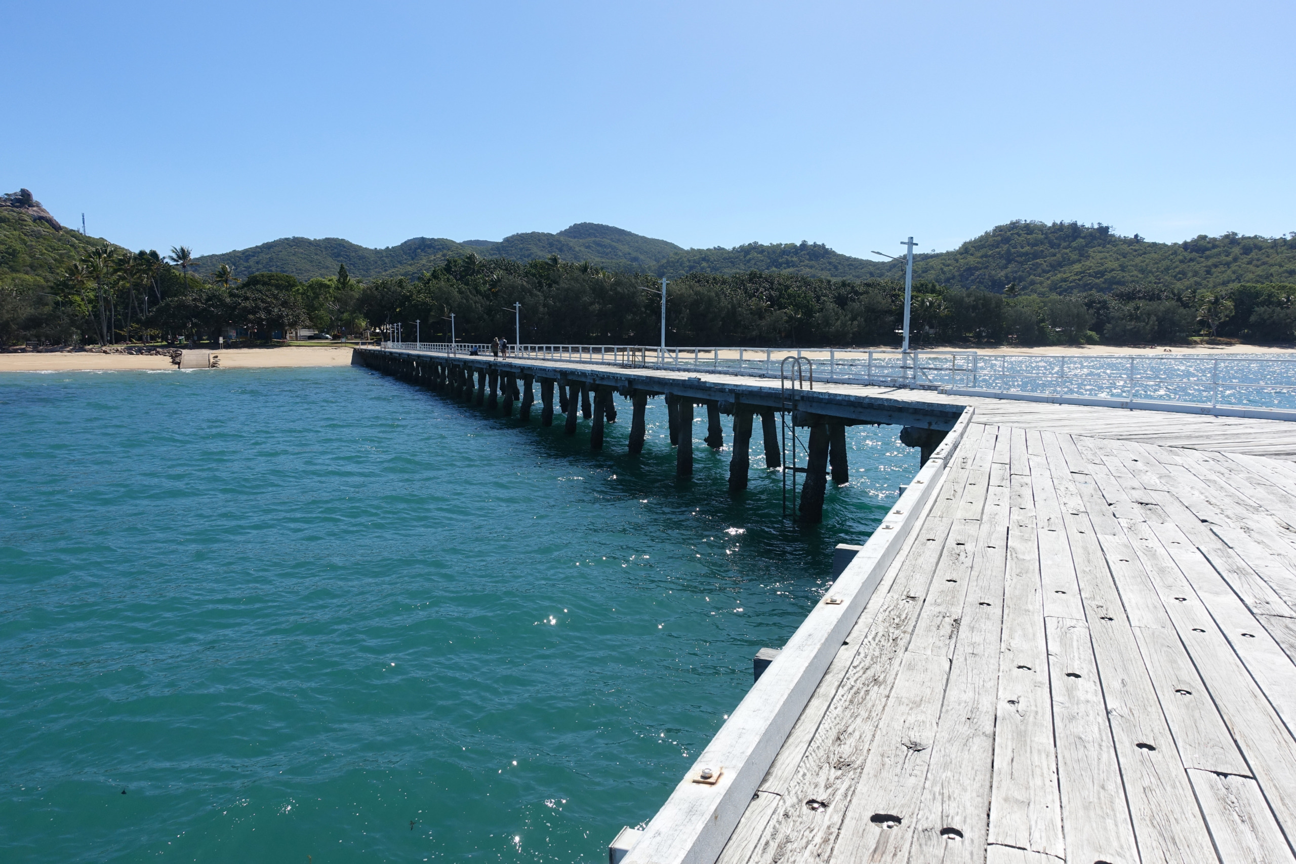
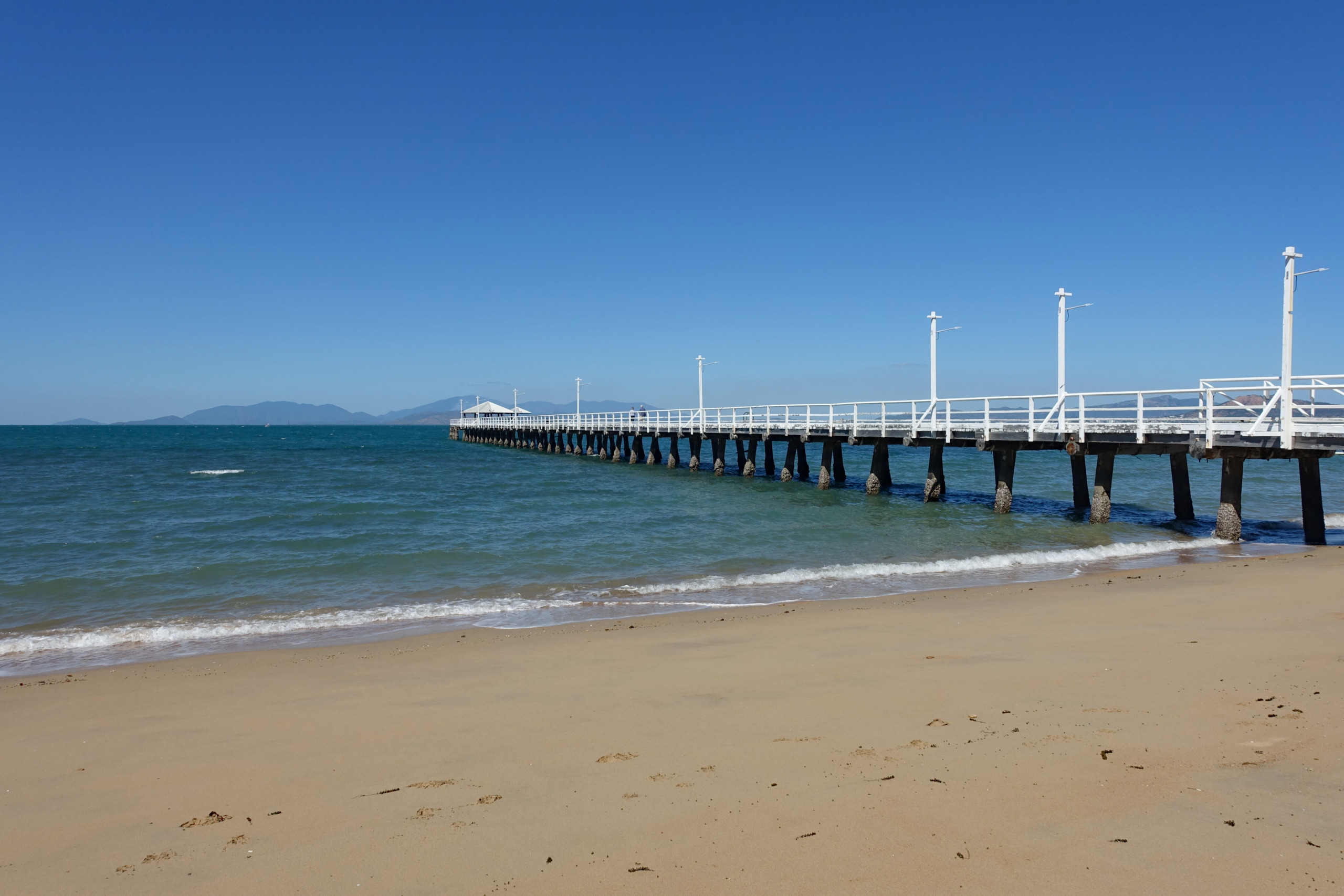
After descending from Hawkings Point Lookout we visited the Picnic Bay Jetty and had a short walk along the beach. The 250 meter long jetty is a historic landmark on Magnetic Island extending out into the calm waters of Picnic Bay. Completed in 1959 it served as the island’s primary gateway to mainland Townsville. When commercial ferry operations shifted to the new terminal in Nelly Bay in the mid-2000’s the jetty was saved and added to the Queensland Heritage Register in 2004.

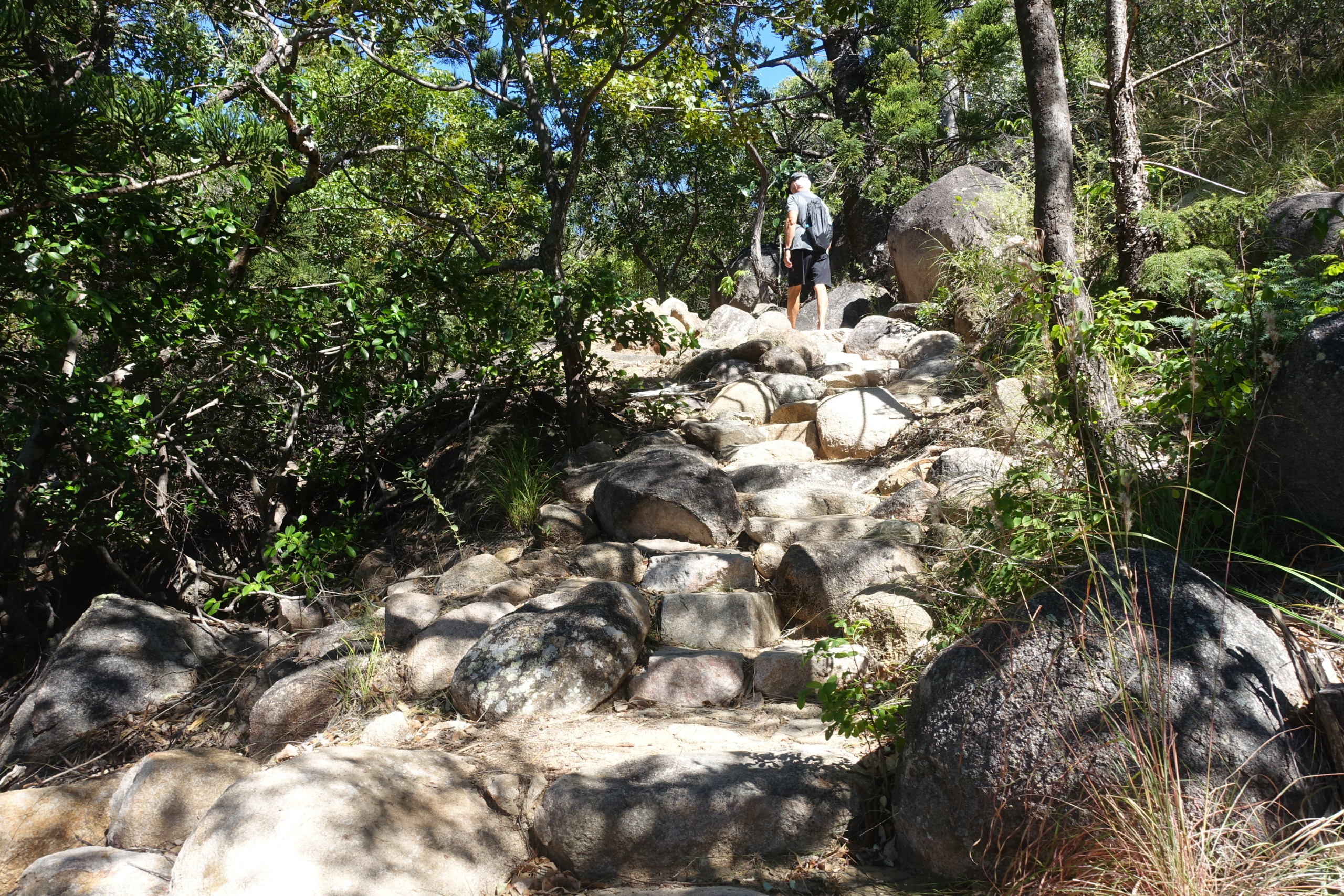
600 meters from our apartment was the trailhead for the hikes to Radical Bay and Balding Bay, both rated Grade 4 walking tracks. The track to Radical Bay is a workout with a stunning beach at the finish line. The path winds up and over the ridge through eucalyptus forest and striking granite boulders. While the climb involved plenty of stone steps that got our hearts pumping, the well-mainained surface made it a manageable adventure. From the trailhead it took about 45 minutes to reach Radical Bay, and it’s simply stunning. While the bay is quite secluded by land it’s easily accessible by boat. When we arrived there was one catamaran in the bay and by the time we left there were 8 boats, including one commercial boat full of tourists, so it was busier than we expected.
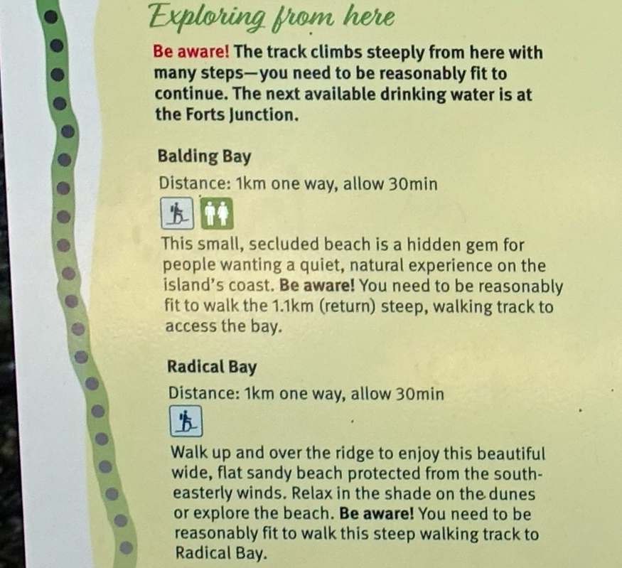
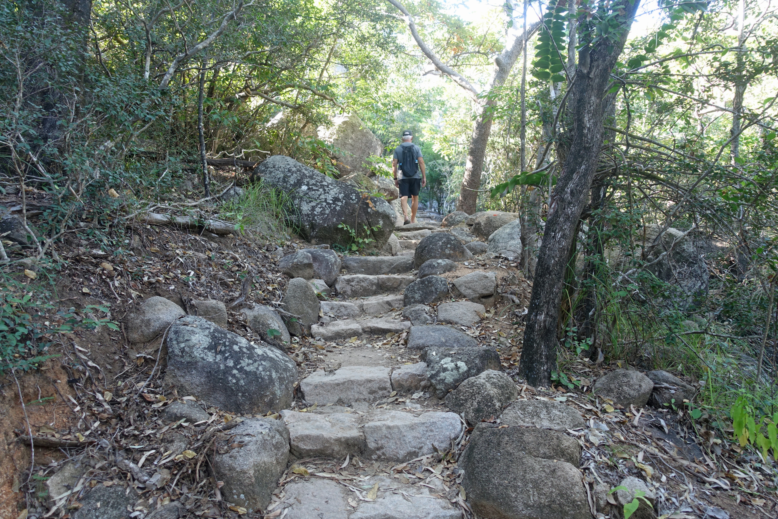
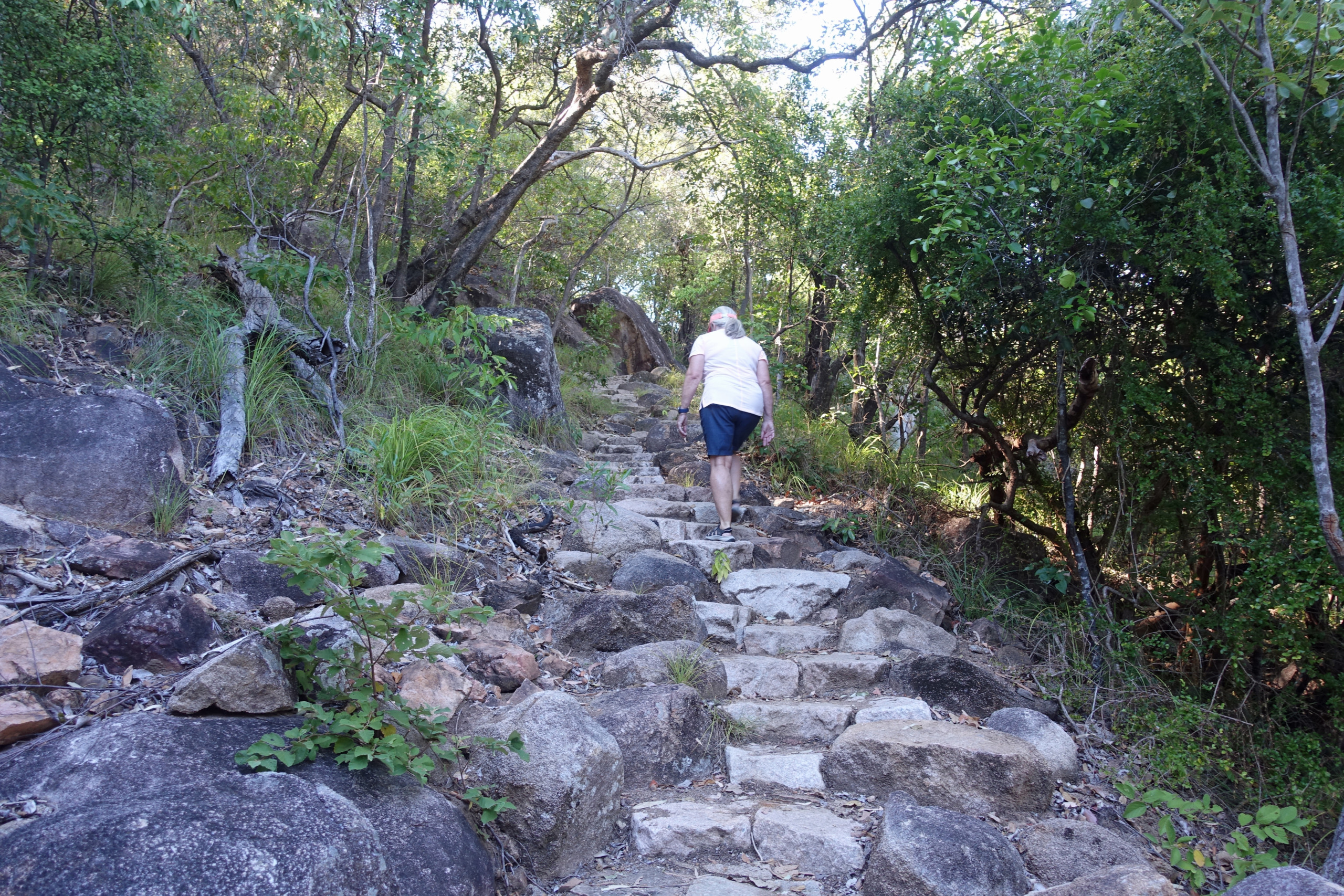
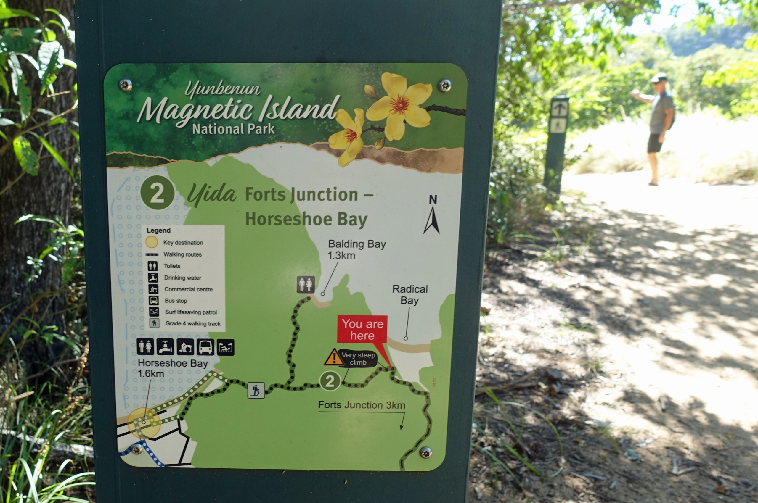


Leaving Radical Bay we headed back up the mountain towards home. Roughly 700m along the trail is the offshoot trail down to Balding Bay. The sign said 550m so we decided to knock that one off as well. The track is shorter but no less difficult with steps and boulders all the way down. Balding Bay is small and there was only one boat there for a very short time. Balding is known as a nude beach but luckily there were only a couple of old guys who decided to bare all 🫣 We had a short rest in the shade of the rocks before tackling the steep climb and the long descent back to Horseshoe Bay. In total we walked 6.93km, none of it flat, but the gorgeous bays were worth it 💪


We’ve enjoyed our week of hiking on Magnetic Island and feel like we covered the highlights. I don’t think we would have wanted to stay any longer than the 6 nights we did. Next up, we’re continuing our trek north in Queensland. Next destination, Wongaling Beach…..
.
.